BUTTE COUNTY (AP/CBS13) — The latest on the Dixie Fire impacting Butte, Plumas and Lassen counties:
The fire is now 463,477 acres, making it the second largest wildfire in California’s history and the largest single wildfire in state history. It is still 21 percent contained.
But cooler overnight temperatures and higher humidity slowed the spread of the fire. Temperatures topped 90 degrees Fahrenheit instead of the and triple-digit highs recorded earlier in the week.
In an update Saturday morning, Cal Fire officials said fire activity in the west zone is expected to decrease through the morning hours. And on the east zone, firefighters are continuing work to protect homes in Crescent Mills and Hunts Valley, and defend the community of Westwood.
A total of 589 structures have been destroyed to date, with another 13,871 still threatened.
Previous day’s updates below:
10 p.m.
As of Saturday evening, the Dixie Fire has burned 447,723 acres while containment has remained at 21 percent. Nearly 14,000 structures remain threatened and 370 have now been destroyed, according to Cal Fire.
Two people still remain unaccounted for from the Greenville area.
7:11 a.m.
Overnight, the fire grew by more than 22,000 acres with containment remaining the same. It is now 446,723 acres with 21 percent containment.
The Plumas County Sheriff’s Department has reported five people missing, many of those from the community of Greenville that was overcome with flames earlier this week.
Evacuations also remain in effect for a number of small communities threatened by lightning-sparked fires in and around national forests.
With cooler temperatures and calmer winds overnight reducing the flames, firefighters were able to slow the fire’s advance northeast. It is now burning in more sparse fuels.
Crews were also able to keep the fire west of Crescent Mills.
Previous day’s updates below:
7:19 p.m.
That fast-growing Dixie Fire continued to spread Friday, now burning 434,813 acres. Containment has been sitting at 35 percent for a while, but Friday evening, that number dropped down to 21 percent, according to Cal Fire.
The amount of contained fire line along the fire’s perimeter has not changed. However, since the total fire acreage has significantly grown, the percentage of containment has decreased to 21 percent
There are still nearly 14,000 structures threatened by the fire, while 184 have been completely destroyed—including homes.
10:34 a.m.
A host of new mandatory evacuation orders have been issued in Lassen County.
Residents in the following areas are now being told to leave:
• Lassen National Forest south of Hwy 36 to the Lassen County line including Hamilton Mtn., Coyote Peak, and Indicator Peak – Zone LAS-E017
• North of Hwy 36 from the Lassen County Line to A21 – Zone LAS-EO27
• South of Hwy. 44 from A21 to McCoy Flat – Zone LAS-E028
• North of Hwy. 36 east of A21 – Zone LAS-EO29
Numerous other evacuation orders remain in effect in Lassen County due to the Dixie Fire, which is still seeing explosive growth.
9:35 a.m.
Much of the northern Central Valley is covered in smoke Friday morning due to California’s wildfires.
According to the National Weather Service, critical fire weather conditions have now passed. However, breezy winds are expected to continue locally through the weekend.
Visible satellite imagery this morning shows much of interior Northern California covered in smoke due to area wildfires. To view the air quality information for your location, visit https://t.co/XYTBpMWUqP. #CAwx pic.twitter.com/8l3ObHSyt1
— NWS Sacramento (@NWSSacramento) August 6, 2021
7:01 a.m.
The Dixie Fire continued its explosive growth overnight, with the wildfire now one of the top three biggest ever recorded in California.
On Friday, Cal Fire announced that the Dixie Fire was now 432,813 acres – a jump of just over 100,000 acres since Thursday. Containment is still being reported at 35 percent.
The day before, the Dixie Fire already ranked as the 6th largest fire recorded in California. Friday’s numbers, however, mean that it has now overtaken the 2020 LNU Lightning Complex Fire (363,220 acres), the 2020 Creek Fire (379,895 acres), and the 2020 SCU Lightning Complex Fire (396,624 acres).
If the Dixie Fire continues to grow, it appears poised to overtake the 2018 Mendocino Complex Fire in the second spot. That fire burned a total of 459,123 acres.
The largest fire in recorded California history remains the 2020 August Complex Fire. That wildfire – which burned across seven counties and destroyed 935 structures – was a total of 1,032,648 acres.
Previous day’s updates below:
7:55 p.m.
The Dixie Fire has grown by nearly 40,000 more acres since Thursday morning, now being reported by Cal Fire as 361,812 acres in size. Containment was still at just 35 percent, the agency said in a Thursday evening press conference.
 More than 5,000 firefighters are battling the blaze, which has ravaged Butte, Plumas and now Lassen counties, forcing thousands of residents from both areas from their homes.
Mop ups of Highway 70 and Butte Road are being performed, Cal Fire said. There was also significant fire growth along Humboldt Road over the last 24 hours with crews trying to contain multiple spot fires.
Evacuation orders were lifted for the town of Greenville, most of which was destroyed by the Dixie Fire this week, leaving homes and other buildings completely leveled. Despite the orders being lifted, people still in the area or nearby areas should be prepared to evacuate immediately if told to do so.
The Dixie Fire’s growth Thursday puts it fewer than 1,500 acres shy of surpassing 2020’s LNU Lightning Complex Fire as the fifth-largest wildfire in California history.
3:43 p.m.
The Plumas County Sheriff’s Office issued another urgent warning that people still in Chester, Hamilton Branch and the Lake Almanor peninsula should evacuate now due to the immediate danger presented by the Dixie Fire.
Evacuees are being asked to head east to Susanville. Shelters are in place at Lassen Community College at 478-200 CA-139 and Lassen High School at 1110 Main Street.
Due to the extreme fire conditions, first responders may not be able to help anyone who stays in those areas, the sheriff’s office said.
1:29 p.m.
Several new Evacuation Orders and Warnings have been issued for the Dixie Fire – including now in Lassen County.
The Lassen County Sheriff’s Office says the following areas are now under an Evacuation Warning:
• Walker Lake area north of Mtn. Meadows Reservoir and south of Moonlight Rd. – Zone E018
• Area east of Mtn. Meadows Reservoir and south of Hwy 36 to Coppervale – Zone LAS-E026
• North of Hwy 36 from the Lassen County Line to A21 – Zone LAS-EO27
• South of Hwy. 44 from A21 to McCoy Flat. – Zone LAS-E028
• North of Hwy. 36 east of A21 – Zone LAS-EO29
Mandatory Evacuation Orders remain in place for the following areas:
• The area south of Hwy 44 from the Lassen County line east to A21 including Silver Lake, Juniper Lake, and the Caribou Wilderness Area -Zone LAS-E031
• The unpopulated area south of Mountain Meadows Reservoir from Hamilton Branch waterway east to the Lassen/Plumas County line. Zone LAS-E019.
Clear Creek, Westwood, and Pine Town area south of Hwy 36 from the Lassen County line east to Moonlight Ranch Rd- Zones LAS-E020 and LAS-E023
A new mandatory Evacuation Order has also been issued in Plumas County:
Taylorsville and surrounding areas including, North Valley Rd, North Arm Rd and Diamond Mtn. Road.
The sheriff’s office says they estimate that about 38 percent of Plumas County residents are under an Evacuation Order.
8:53 a.m.
The Dixie Fire has again exploded in size, growing by nearly 50,000 acres overnight.
Cal Fire reports that, as of Thursday morning, the Dixie Fire has grown to 322,502 acres. It is still just 35 percent contained, the same number it has been stuck at since last weekend.
Firefighters say the extreme fire behavior was fueled overnight by low relative humidity and strong winds.
Numerous evacuation orders remain in effect.
With the acreage jump, the Dixie Fire has now become the 6th largest wildfire in recorded California history. Notably, with the Dixie Fire continuing its explosive growth, 6 of the top 7 largest wildfires have now happened either in 2020 or 2021.
Previous day’s updates below:
4:03 p.m.
The Plumas County Sheriff’s Office said the community of Chester, adjacent to Lake Almanor, should immediately evacuate to the east. If residents are not able to evacuate and are threatened by the fire, they are advised to take refuge at the Chester High School baseball field.
11:37 a.m.
Evacuation orders are now in effect for parts of Tehama County, specifically St. Bernard’s Lodge and Elam-Carter Creek areas.
8:09 a.m.
After an extremely active day that prompted several new evacuation orders, the Dixie Fire has now grown to be the 8th largest wildfire in recorded California history.
Flames shoot into the sky as the Dixie Fire jumps across Highway 89 near Greenville on August 3. (Photo by JOSH EDELSON/AFP via Getty Images)
As of Wednesday morning, Cal Fire reports that the Dixie Fire had jumped in size to 274,139 acres. This is a nearly 20,000-acre size increase from the day before.
At the start of the week, the wildfire was already the 11th largest in state history – but it has since now topped the 2013 Rim Fire (at 257,314 acres), the 2012 Rush Fire (at 271,911 acres), and the 2003 Cedar Fire (at 273,246 acres).
Firefighters continue to be concerned with extremely dry conditions and wind. A Red Flag Warning has been issued by the National Weather Service for parts of Northern California – including most of the Dixie Fire area.
The wildfire remains only 35 percent contained, the same number it has been at since the weekend.
An expansive list of evacuation orders remain in effect. For the latest information, head to Cal Fire’s website.
Previous day’s updates below:
9:22 pm.
The Dixie Fire has grown to 254,466 acres and is 35 percent contained. It has destroyed 45 structures.
5:24 p.m.
Plumas County Sheriff’s Office:
“Due to the #DixieFire a MANDATORY EVACUATION ORDER has been issued for:“ALL OF CHESTER, from the Hwy 36 Hwy 89 junction, east to the Causeway. The intersection of Old Red Bluff Hwy and Warner Valley Rd., east to Lake Chance Campground, south to SR36 on the causeway, southwest to the intersection of SR89 and SR36, north to the intersection of Old Red Bluff Hwy and Warner Valley Road.
“ALL OF THE PENINSULA AND HAMILTON BRANCH from SR36 on the causeway, east to the Lassen County Line, south on SR147 to County Road
“A13, south to Peninsula Point, north to the SR36 causeway.
“You should evacuate to the east, to the shelter in Susanville at the Lassen Community College at 478-200 CA-139.
“Those who need transportation should call 530-283-6414.”
3:41 p.m.
Plumas County Sheriff’s Office:
“A MANDATORY EVACUATION ORDER has been issued for: The community of the northeast side of Indian Valley. The Order includes Dyer Mountain, southeast to Keddie Ridge, southeast to Diamond Mountain Road, west to Stampfli Lane, north to Wolf Creek, northwest to the intersection of N Valley Road and Pecks Valley Road, north to the intersection of Williams Valley Road and Lower Williams Valley Road, northwest to SR89 at Second Water Tower Creek, north to Dyer Mountain.
“You should evacuate to the south, toward Quincy to the shelter at 59 Bell Lane.
Those who need transportation should call 530-283-6414
“We are in the process of demobilizing the evacuation shelter in Chester due to capacity and other logistical reasons. A NEW SHELTER IS BEING OPENED AT LASSEN COMMUNITY COLLEGE, LOCATED AT 478-200 CA-139, SUSANVILLE, CA. Transportation from the Chester shelter is being coordinated for those currently checked in.”
1:58 p.m.
More evacuation orders have been issued due to the Dixie Fire on Tuesday.
The following areas are now under mandatory evacuation orders, per the Plumas County Sheriff’s Office:
East Shore of Lake Almanor; this includes, the intersection of SR147 and County Rd. A13, east to Little Dyer Mountain, southeast to Dyer Mountain, south to SR89, west to SR147, north to County Rd. A13. (Map link: https://tinyurl.com/ydrapp24)
An evacuation warning has also been issued for the following areas as fire activity increases:
Chester; From the Hwy36/Hwy89 Junction, east to the causeway, both sides of Hwy 36 through Chester to the Lake Almanor edge and to north to the County Line.
9:54 a.m.
The Plumas County Sheriff’s Office says several new evacuation orders have been issued:
Hwy 36/Hwy 89 Junction south to Lake Almanor West Drive and everything east to the Lake Almanor water line. This includes the entire “LAW” subdivision and Prattville and Canyon Dam, from Canyon Dam northwest to Hwy 89 and just south of Lake Almanor West Drive. This includes Big Meadows, the Rocky Point Campground, the Canyon Dam Boat Launch.
An evacuation WARNING has been issued for:
Lake Almanor Peninsula; includes, Hamilton Branch, Bailey Creek, the North Shore Campground, and all of the Lake Almanor Peninsula community.
7:38 a.m.
After prompting new evacuation orders on Monday, the Dixie Fire continues to grow – even as containment numbers hold steady.
As of Tuesday morning, Cal Fire reports that the wildfire has grown to 253,052 acres. It is still 35 percent contained, the same number as Monday.
The size makes the Dixie Fire the 11th largest in recorded California history, but it’s slowly edging closer to the 10th spot.
Numerous evacuation orders remain in effect, and Highway 70 at Deadwood Road remains closed.
Previous day’s updates below:
7:45 p.m.
Plumas County Sheriff’s Office:
“As of 8-2-2021 at 7:20 PM, per Sheriff Johns, after further evaluating the fire, its progression and current position, Crescent Mills is NOT included in the Mandatory Evacuation Order and is to only remain in a Warning at this time. The map will take some time to be changed.”
6:45 p.m.
Plumas County Sheriff’s Office:
“Due to increased fire activity on the #DixieFire a Mandatory Evacuation Order has been issued for:
“Everything west of Hwy 89/36 Junction, west along the southside of Hwy 36 to the County line and south of Hwy 36 to Rock Lake and west to the County Line. Those evacuating from the above area should go to the shelter at the Memorial Hall in Chester at 180 Gay Street.
“A warning has been issued for: the north side of Hwy 36 from the Hwy 89/Hwy36, north along Stover Mtn Rd and west to the County Line.
“MAP LINK: https://tinyurl.com/ydrapp24 If you need transportation out of the Mandatory Evacuation area you need to call: 530-283-6414 CAL FIRE/Butte County U.S. Forest Service-Plumas National Forest Lassen National Forest”
5:36 p.m.
Plumas County Sheriff’s Office:
“Due to increased fire activity on the #DixieFire , Sheriff Johns has issued a Mandatory Evacuation Order for:
“Canyon Dam south to include Greenville and south of Greenville to include Crescent Mills.
“You should EVACUATE SOUTH TOWARDS QUINCY, immediately. Hwy 89 is open to evacuate out of the area above; however, it is being closed to northbound traffic at Hwy 89 and Hwy 79 junction (Greenville Wye) and closed to southbound traffic at the Hwy 89/Hwy 147 junction.
“There is a shelter at 59 Bell Lane in Quincy, the Springs of Hope Church. If you need transportation out of the Mandatory Evacuation area you need to call: 530-283-6414 CAL FIRE/Butte County U.S. Forest Service-Plumas National Forest Lassen National Forest”
7:44 p.m.
Firefighters say they are expecting fire behavior to increase on Monday due to drying conditions.
The growth of the Dixie Fire slowed considerably over the weekend, with Cal Fire reporting as of Monday morning that the wildfire had burned 248,820 acres. It is 35 percent contained.
Cal Fire says they now expect full containment of the Dixie Fire by mid-August.
11:28 p.m.
Since midday Sunday, containment on the Dixie Fire slightly increased from 32 to 33 percent. Acreage burned grew to 248,570.
According to Cal Fire, full containment of the fire is expected to be reached by August 13.
12:45 p.m.
Fire containment improved overnight, up 32 percent from 30 percent Saturday. It is currently 244,888 acres and has destroyed 45 structures.
It is the 11th largest wildfire in California’s history after starting July 13. The cause remains under investigation.
On Sunday, many residents in both counties were allowed to return home as Highway 89 reopened. However, officials warned that there could still be smoldering tree stumps or other “hot” spots in the area, but there is no need to report them to the fire department.
It is recommended to not drink the water as an assessment of the water supply has not been performed, according to the Plumas County Public Health agency, which recommends using bottled water.
Saturday’s updates below:
California’s largest wildfire so far this year is flaring up, but authorities say it’s because flames are chewing through unburned islands of vegetation within a perimeter that firefighters have built.
It has destroyed more than 40 homes and other buildings and continues to threaten more than 10,000 on Saturday.
8:59 a.m.
Butte County has lifted the evacuation warning for the Pulga and East Concow areas, while the Butte Meadows, Jonesville and Lake Philbrook areas remain under an evacuation order. And, Inskip remains under an evacuation warning.
In Plumas County, the warning for the town of Chesters has been lifted, and several orders around Lake Almanor have been reduced from orders to warnings. For a complete list by address, go here.
7:26 a.m.
The fire is now 24 percent contained and 240,795 acres.
Fire is expected to increase today due to drying conditions, according to Cal Fire.
Friday’s updates below:
The Plumas County Fair has moved to Sierraville due to the Dixie Fire.
Fair organizers issued a statement on Facebook announcing the reason for the change, that reads:
“The projected containment date for the Dixie Fire is right in the middle of our Livestock Show, and that’s no guarantee that the fire will be out. Roads are still closed, parts of the County will still likely be under some evacuation orders and we are one strong wind event away from this getting ahead of us again. Throw in air quality and it’s just seems like we’re asking for an anxious and unpleasant Fair.” Read the full post.
11:50 a.m.
The Dixie Fire has grown to 240,595 acres and is 24 percent contained.
#RT @CAL_FIRE: #DixieFire off Above the Cresta Dam, Feather River Canyon in Butte County is 240,595 acres and 24% contained. Unified Command: @CALFIRE_ButteCo
and @LassenNFhttps://t.co/IhE7Fc0tOR pic.twitter.com/VOYbvajFAP— CAL FIRE PIO (@CALFIRE_PIO) July 30, 2021
#DixieFire Incident AM Update 7.30.21 English and Spanish
Actualizacion Delincendio Dixie Fecha:07/30/2021 Hora: 7:00 a.m.
Click Here: https://t.co/gjfsmJh5ac
Most recent updates for the evacuation maps and email list for the incident are provided at the above link. pic.twitter.com/KbpK6ugoF2
— CAL FIRE Butte Unit/Butte County Fire Department (@CALFIRE_ButteCo) July 30, 2021
Previous day’s updates below:
7:15 p.m.
Cal Fire said the Dixie Fire has grown to burn 226,421 acres as of Thursday evening. At least 42 structures have been destroyed, while more than 10,600 more remained threatened by flames.
The Plumas County Sheriff’s Office said this afternoon that the following areas were no longer under evacuation warnings:
- Moonlight Valley, Engel Mine, Lone Rock Valley, and a Portion of Growers Boulevard: USFS Road 28N32 Intersection of Plumas/Lassen Line, east to Diamond Mountain area, South to Lone rock.
- Kettle Rock, Taylor Lake, Wilcox Valley, Rattle Snake Peak, and Franks Valley: Taylor Diggings Mine north to Engel Mine, East to Lower Lone Rock, South to the Border of Zone 28, West to the Taylor Diggings Mine.
- Lone Rock, west of Antelope Lake and north to the county line: Antelope Lake Rd at the base of the grade north on Antelope Lake Rd to the county line, west to the boundary to of zone 19 and 20.
For more information on mandatory evacuations, go here.
12:57 p.m.
The Dixie Fire has grown to 221,504 acres and is 23 percent contained.
The Cal Fire Butte Unit expects to see large plumes of smoke from the Dixie Fire as areas of unburned fuel from within containment lines continue to burn. Firefighters refer to these areas as “islands.”
#DixieFire Today, we expect to see large plumes of smoke from the Dixie Fire as areas of unburned fuel from within containment lines continue to burn. Firefighters refer to these areas as "islands." pic.twitter.com/m0xtroZgpg
— CAL FIRE Butte Unit/Butte County Fire Department (@CALFIRE_ButteCo) July 29, 2021
Smoke from the #DixieFire will continue to impact portions of #NorCal today. Here's a look at the forecast for the near surface smoke through tonight. You can view an updated version of this map anytime at https://t.co/DLEkohlQpz #CAwx pic.twitter.com/wVNdTEHhZz
— NWS Sacramento (@NWSSacramento) July 29, 2021
Previous day’s updates below:
8:54 p.m.
The Dixie fire now sits at 220,012 acres and is 23 percent contained. Below is the latest incident update from Cal Fire.
#RT @CAL_FIRE: #DixieFire off Above the Cresta Dam, Feather River Canyon in Butte County is 220,012 acres and 23% contained. Unified Command: @CALFIRE_ButteCo and @LassenNF https://t.co/IhE7Fc0tOR pic.twitter.com/nbORpuNus4
— CAL FIRE PIO (@CALFIRE_PIO) July 29, 2021
3:31 p.m.
Here are some air quality resources:
Air Quality
Find out when it’s healthy to resume normal activities outside, or what precautions to take if you do venture outdoors.
Fire & Smoke Maps
See which fires are sending smoke into your area and how long experts say it could last.
Cameras
Get a near-real-time view of smoke from fires.
Weather
Health
For even more in-depth smoke resources, check out the California Smoke Information blog.
11:15 a.m.
Smoke from the Dixie Fire is starting to drift down into the Central Valley Wednesday morning.
According to the National Weather Service, the smoke is streaming through Feather River Canyon.
Forecasters say the smoke should start clearing by later Wednesday as the onshore flow increases.
Temperatures across the valley are expected to reach the triple-digit mark on Wednesday.
Wondering why the sky looks hazy/smoky today? Satellite view shows that smoke is streaming from the Dixie Fire through Feather River Canyon then southward down the Central Valley. #dixiefire #CAwx pic.twitter.com/bP9REV5JNJ
— NWS Sacramento (@NWSSacramento) July 28, 2021
8:09 a.m.
The Dixie Fire has now grown to 217,581 acres as of Wednesday morning.
Containment still stands at just 23 percent, Cal Fire reports.
Cal Fire also revealed that a total of 35 structures have been destroyed so far. It’s unclear how many of those structures, if any, are homes.
Favorable conditions and light rainfall helped keep fire activity to a minimum in the west zone of the wildfire. Crews are still concerned about the east zone of the fire, however, with firefighters working through the night to try and expand and secure containment lines.
With temperatures expected to climb again, firefighters are expecting fire activity to increase day and night for the next several days.
Previous day’s updates below:
8:33 p.m.
The Dixie Fire now stands at 212,799 acres and is 23% contained.
The fire is expected to remain active throughout the night. Fire crews continue to construct and reinforce control lines, protect structures, and fall trees that threaten containment efforts.
The fire is expected to produce dense smoke that will blanket the Lake Almanor area and settle into surrounding valleys through the night.
Northeast down-canyon winds will carry smoke pooling in Feather River Valley downstream to the southwest.
Drought conditions are extreme in the region and the large dead fuels are very dry.
Grasses are cured and fuel moistures are historically low causing spot fires to be the biggest threat to containment efforts. The main fire activity will continue into the drainages in the North and West sides of the fire as unburned interior fuels are consumed.
#RT @CAL_FIRE: cont. pic.twitter.com/TaZZq8JUuS
— CAL FIRE PIO (@CALFIRE_PIO) July 28, 2021
6:35 p.m.
The Dixie Fire now stands at 208,206 acres and is 23% contained. More than 4,000 people remain under mandatory evacuation orders. There are 5,000 firefighters battling the fire.
It is now the 14th largest fire in recorded California history.
9:10 a.m.
The Dixie Fire has now surpassed 200,000 acres.
As of Tuesday morning, per Cal Fire’s latest numbers, the wildfire has burned 208,206 acres and is just 23 percent contained.
Firefighters say spotting remains the biggest threat from the wildfire. With some winds in the forecast on Tuesday, crews are on alert.
On Monday, advantageous weather conditions helped firefighters get a better handle of the east zone of the wildfire. Further, the thick blanket of smoke helped act as shade and further decreased temperatures.
Numerous evacuation orders remain in effect. Head to Cal Fire’s website for the latest information.
Previous day’s updates below:
7:52 p.m.
The fire now sits at 198,021 acres and is 22 percent contained. Twenty-two is also the number of structures destroyed, along with 14 minor structures. Seven structures have been damaged.
11:24 a.m.
The Dixie Fire is quickly getting close to 200,000 acres burned.
On Monday, Cal Fire reported that the wildfire had grown to 197,487 acres. Containment is also up to 22 percent.
Part of the reason for the big jump in acreage was the Dixie Fire merging with the nearby Fly Fire over the weekend.
Firefighters are hopeful that, with temperatures decreasing a bit, that fire behavior will be moderating, allowing for easier work on dozer and hand lines.
Numerous evacuation orders remain in place. For the latest information on evacuation orders, head to Cal Fire’s website.
Previous day’s updates below:
10:15 p.m.
The Plumas County Sheriff’s Office said more than 4,000 county residents are under mandatory evacuation orders. Authorities said there isn’t an immediate plan to evacuate the town of Quincy, however, the situation remains monitored.
Damage assessments are being conducted where possible.
9:00 p.m.
In addition to the 16 structures that have been destroyed, at least one other has been damaged. According to Cal Fire, the Dixie Fire slightly grew into the night to burn 192,849 acres while it remained 21% contained.
Evacuation orders for several areas remain in place. That information can be found below.
4:30 p.m.
According to the Placer County Sheriff’s Office, mandatory evacuations have been expanded to include the east shore of Lake Almanor, including Highway 147 from Canyon Dam north to the Highway 147 and County Road A-13 intersection, as well as east of Highway 147 at County Riad A-13 to Little Dyer Mountain and southeast to Dyer Mountain.
Authorities advise evacuating to the north as an evacuation shelter was established at Lassen Community College in Susanville.
Additionally, as mandatory evacuation orders have expanded, evacuation warnings are now in place for the following areas: Moonlight Valley, Engel Mine, Lone Rock Valley, a Portion of Growers Boulevard, Kettle Rock, Taylor Lake, Wilcox Valley, Rattle Snake Peak, Franks Valley, Babcock Crossing, Elephants Playground, Murdock Crossing, Walker Mine, the west portion of Grizzly Valley, Mt. Ingalls, Greenhorn, Spring Garden and Massack.
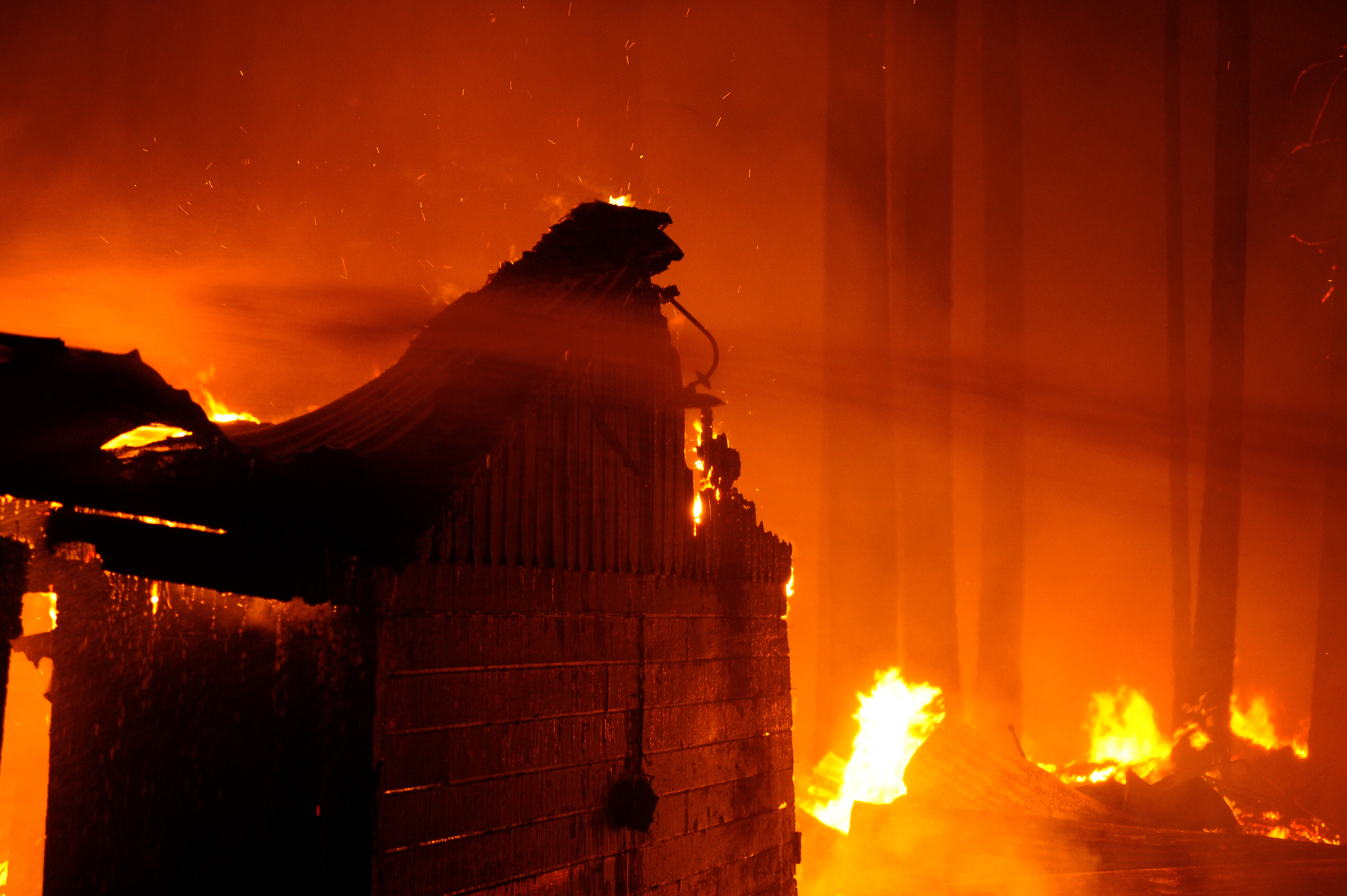
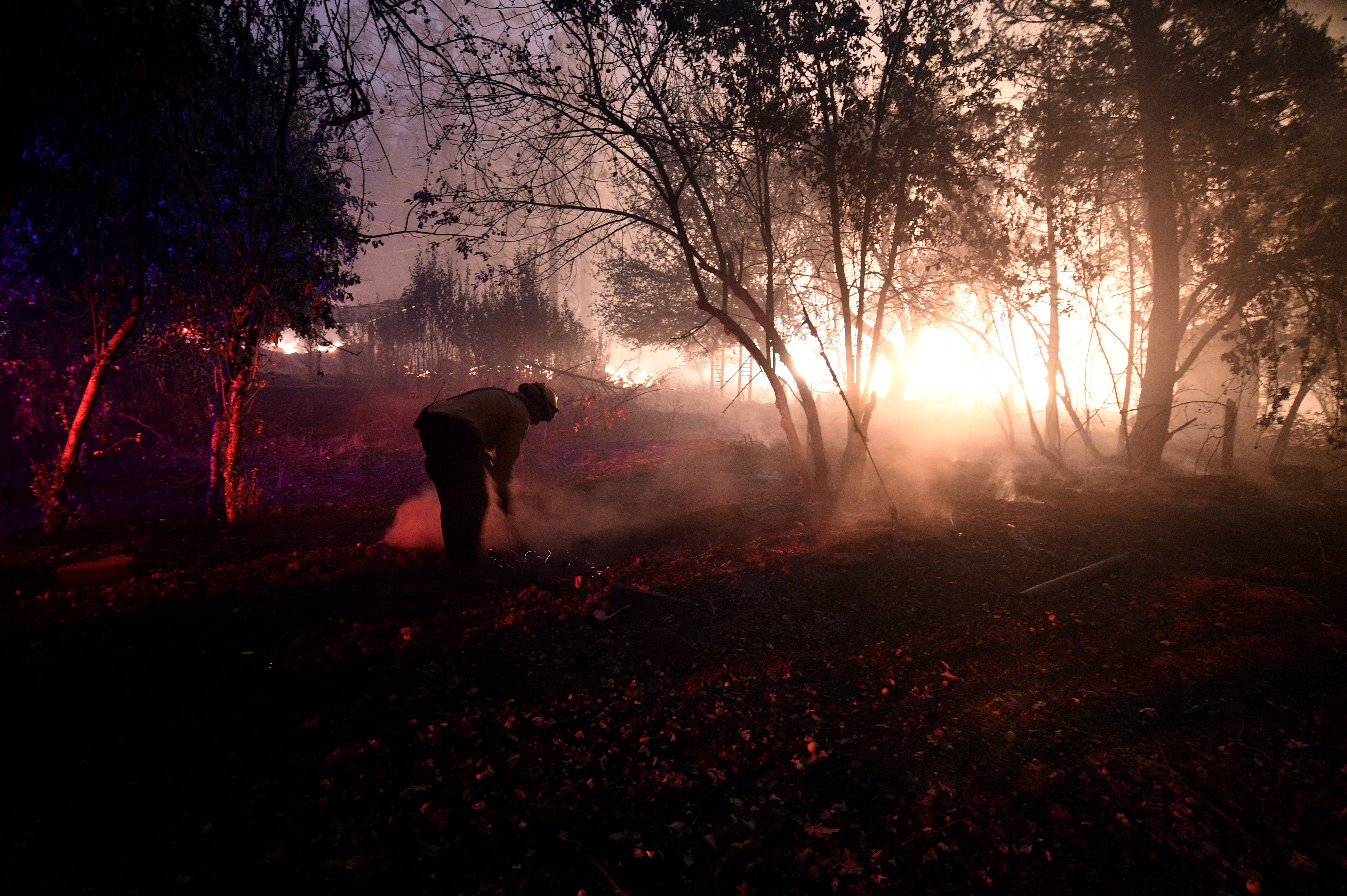
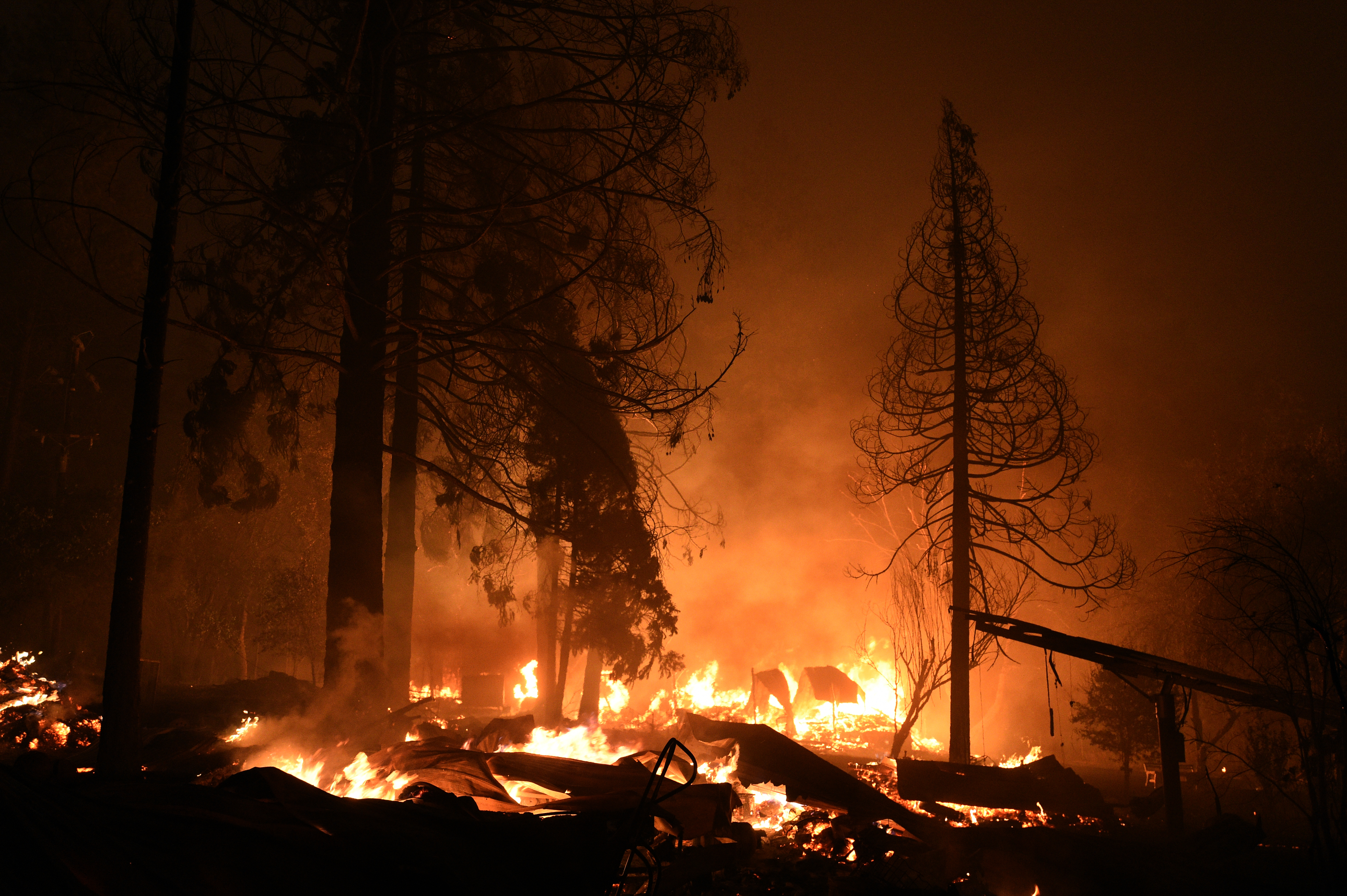
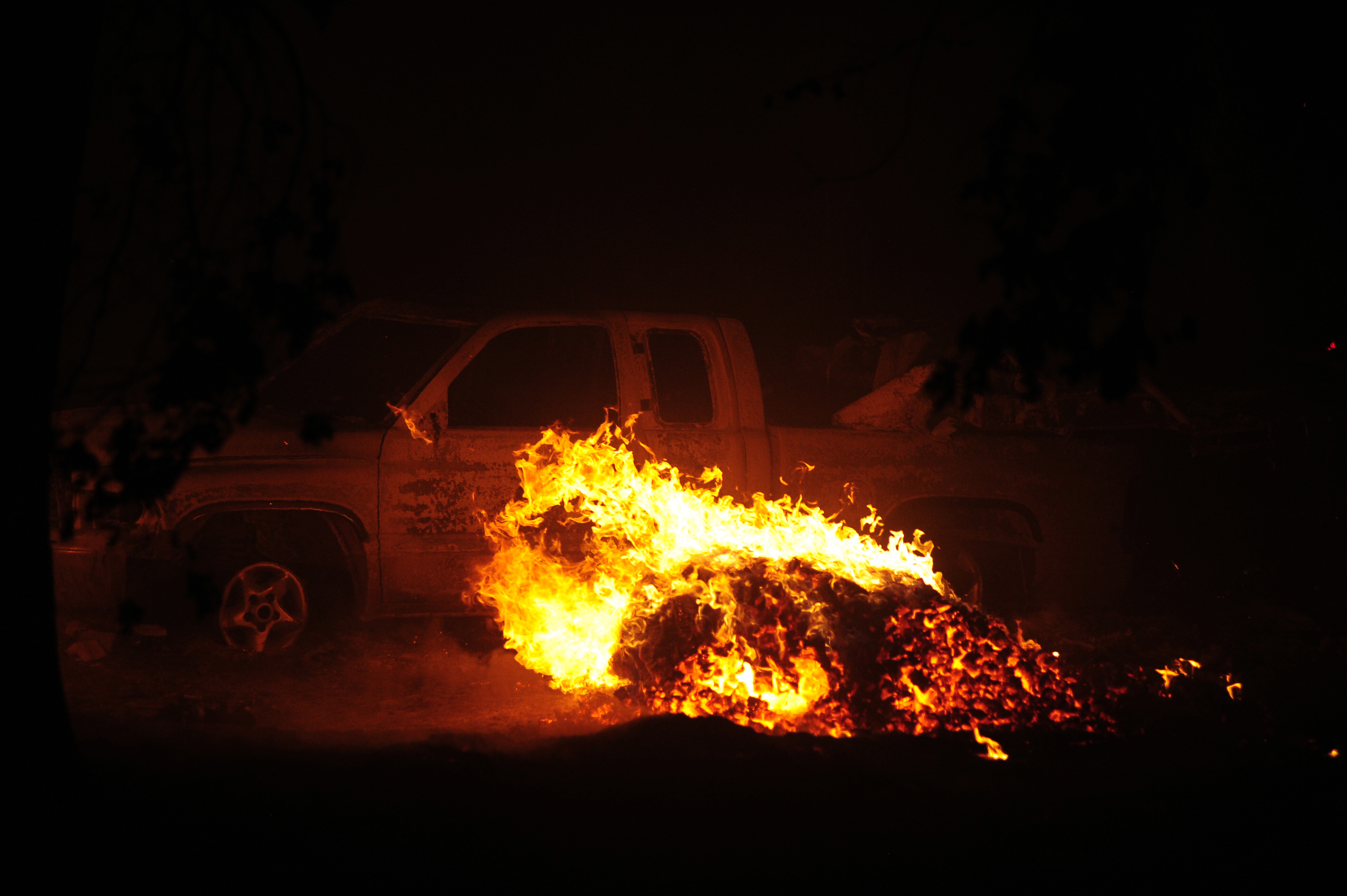
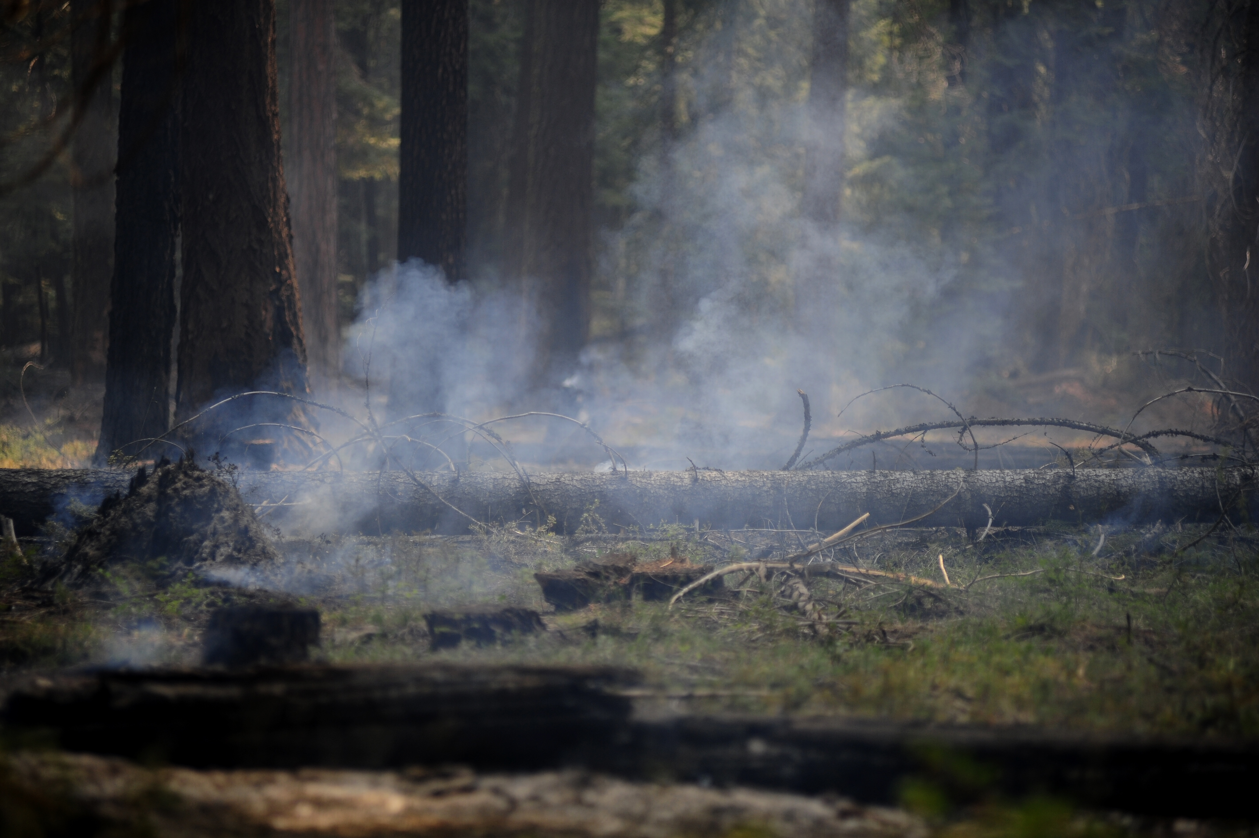
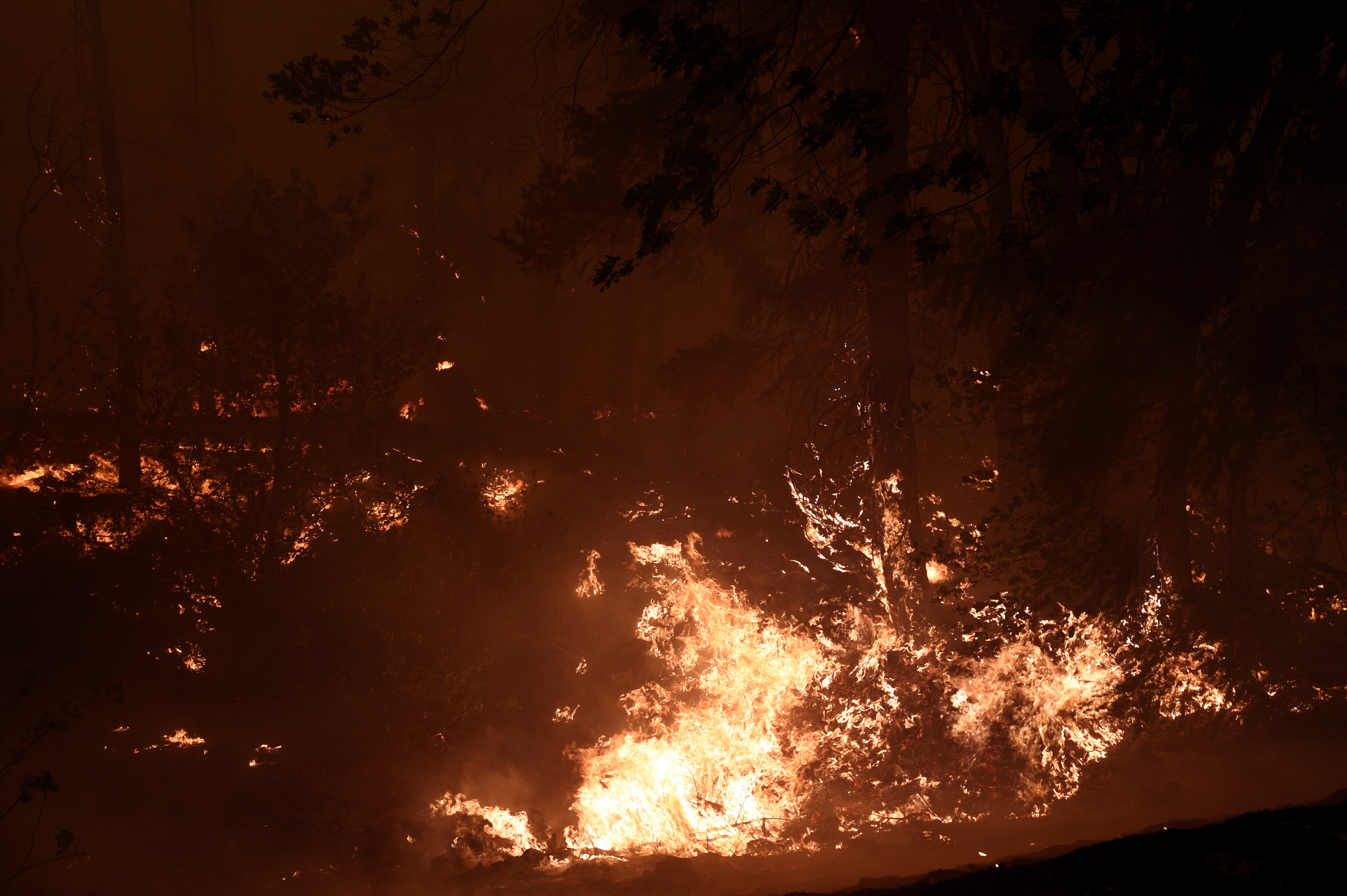
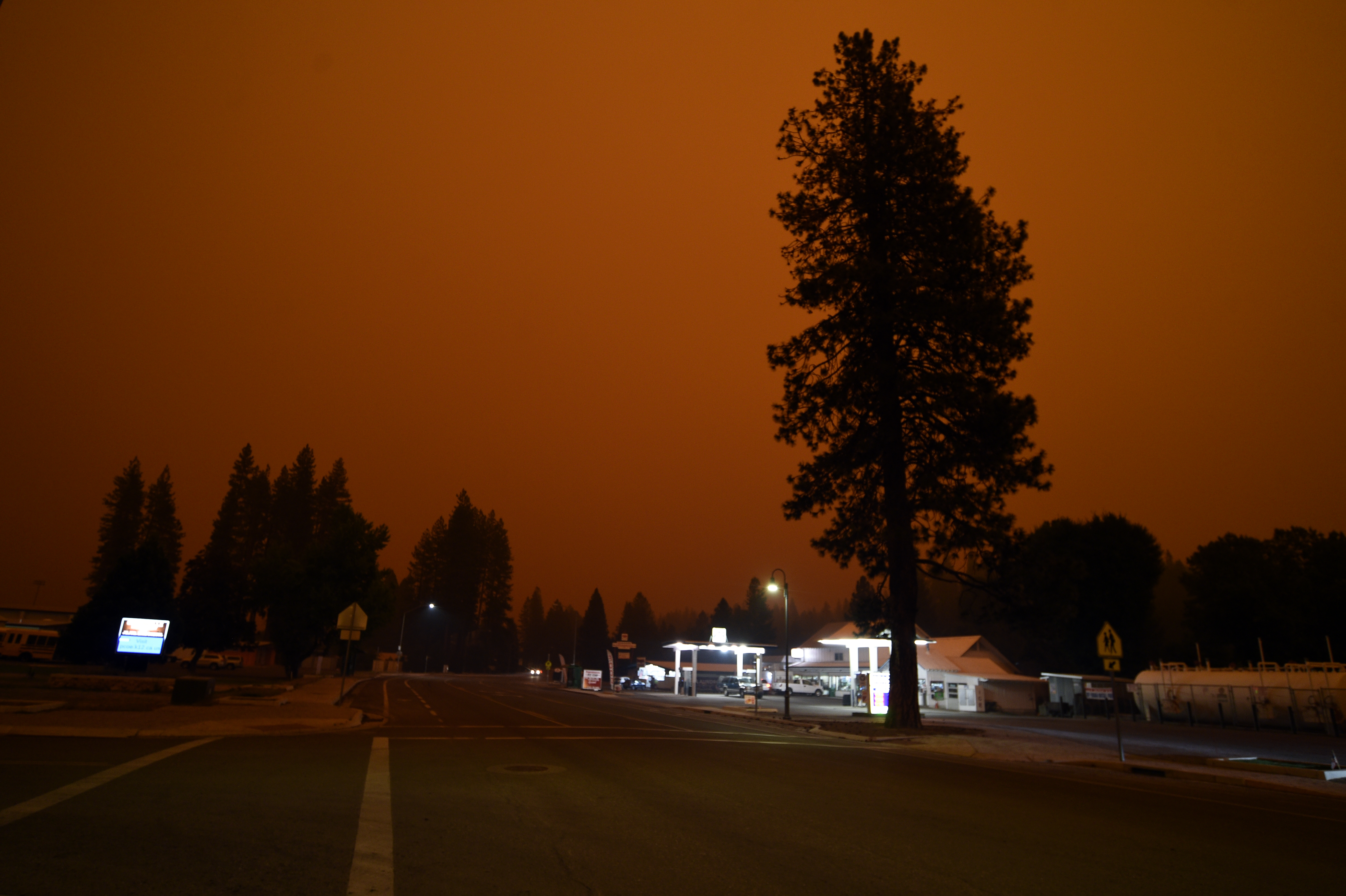
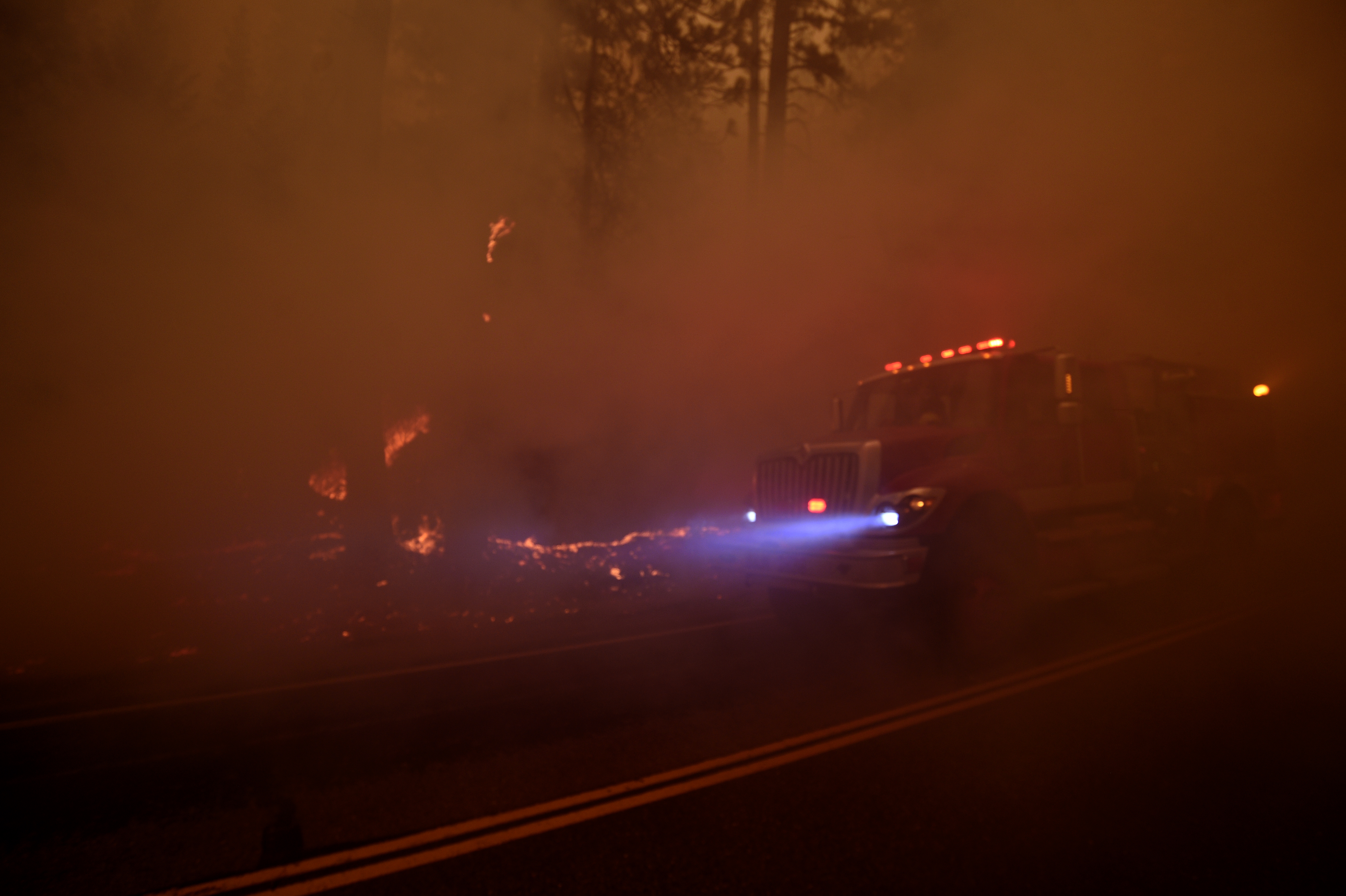
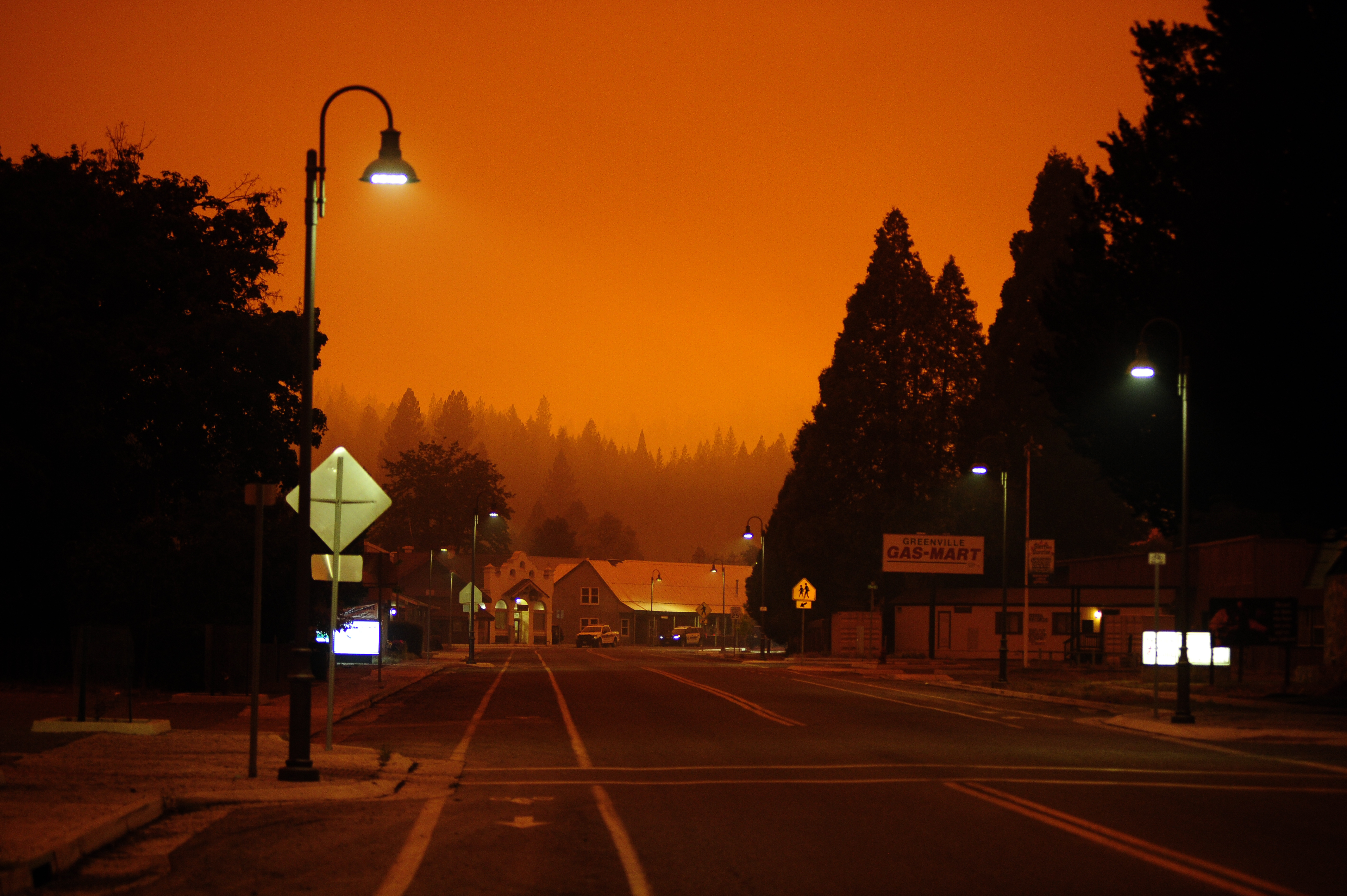
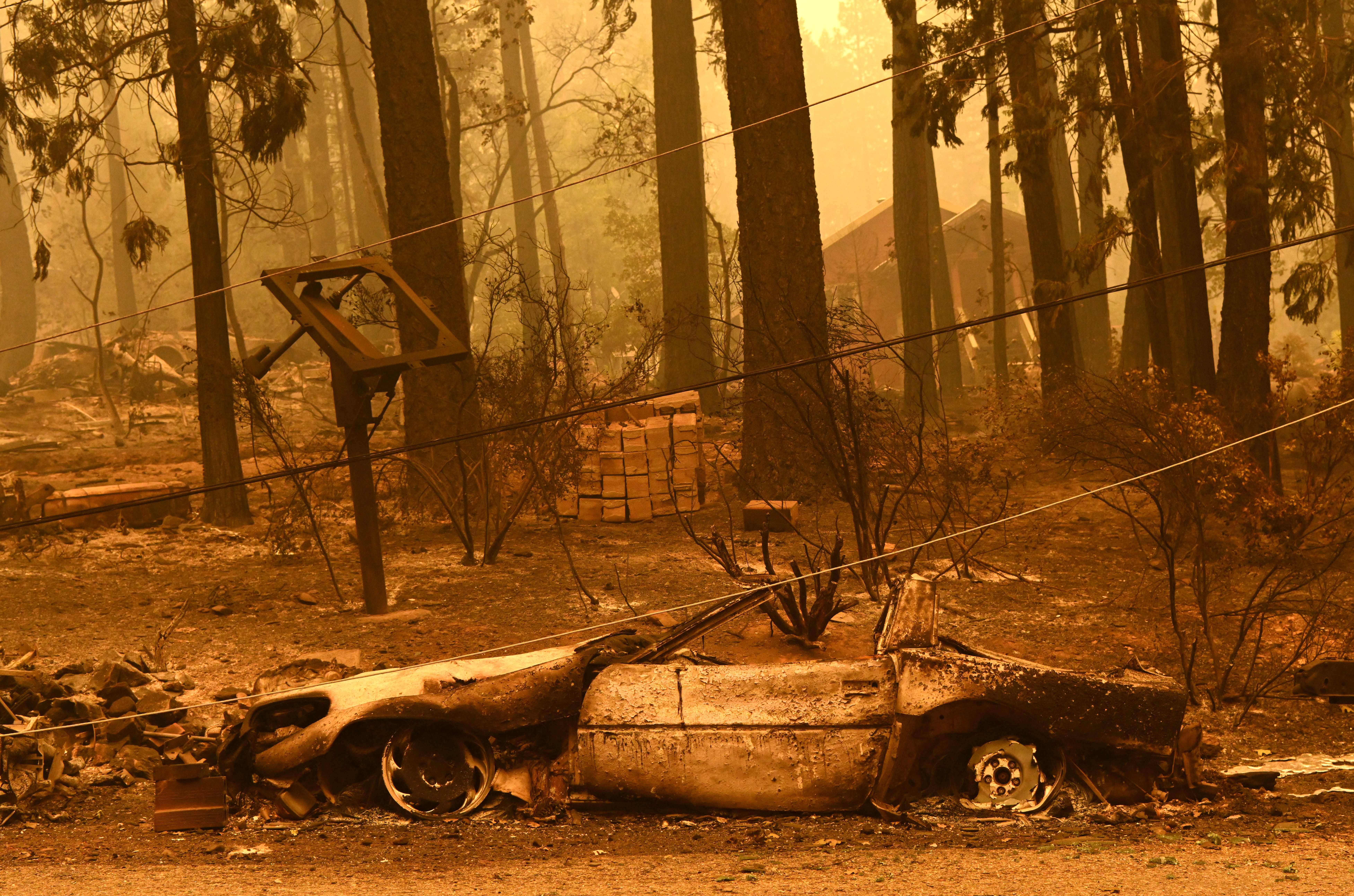
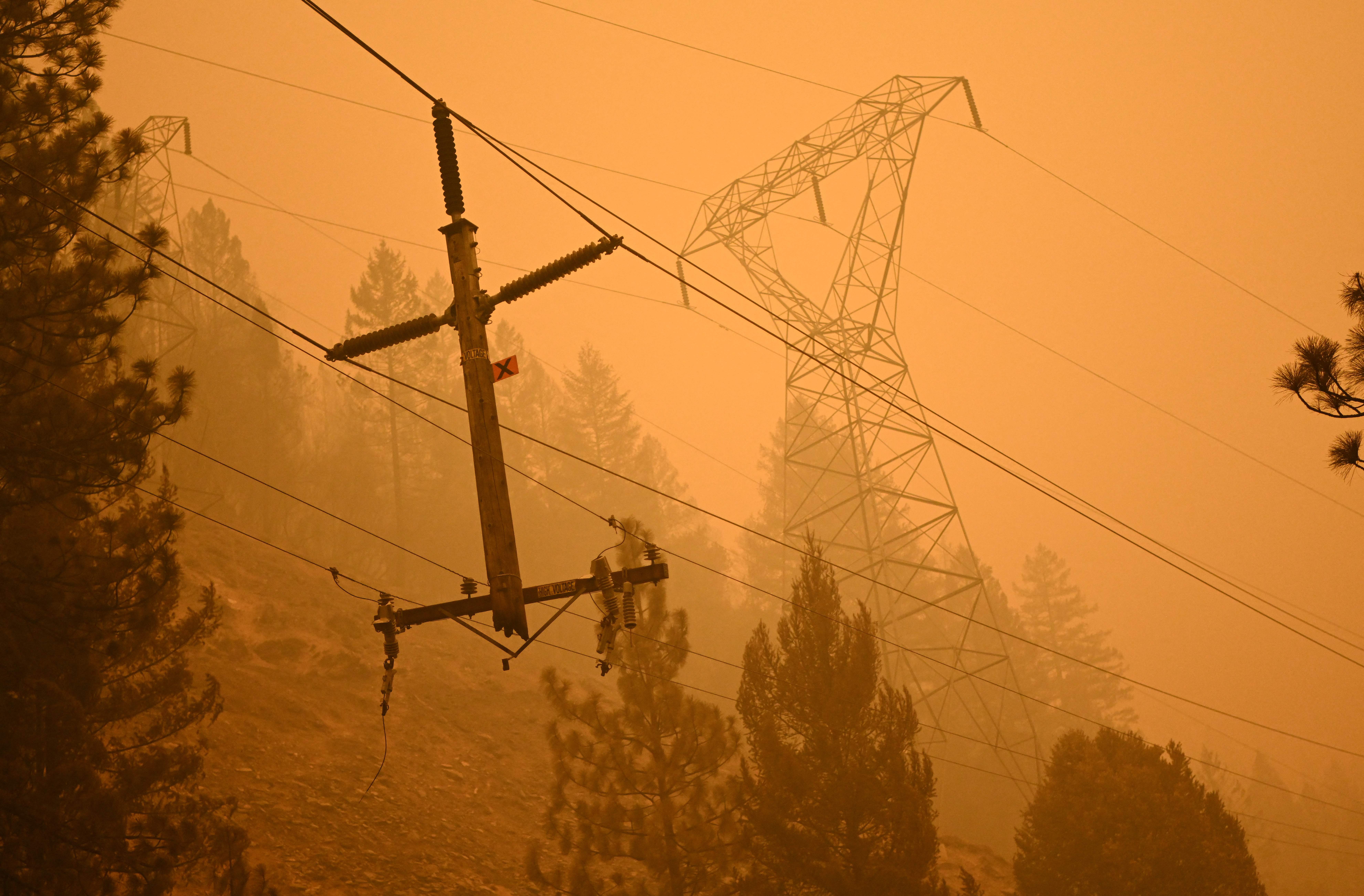
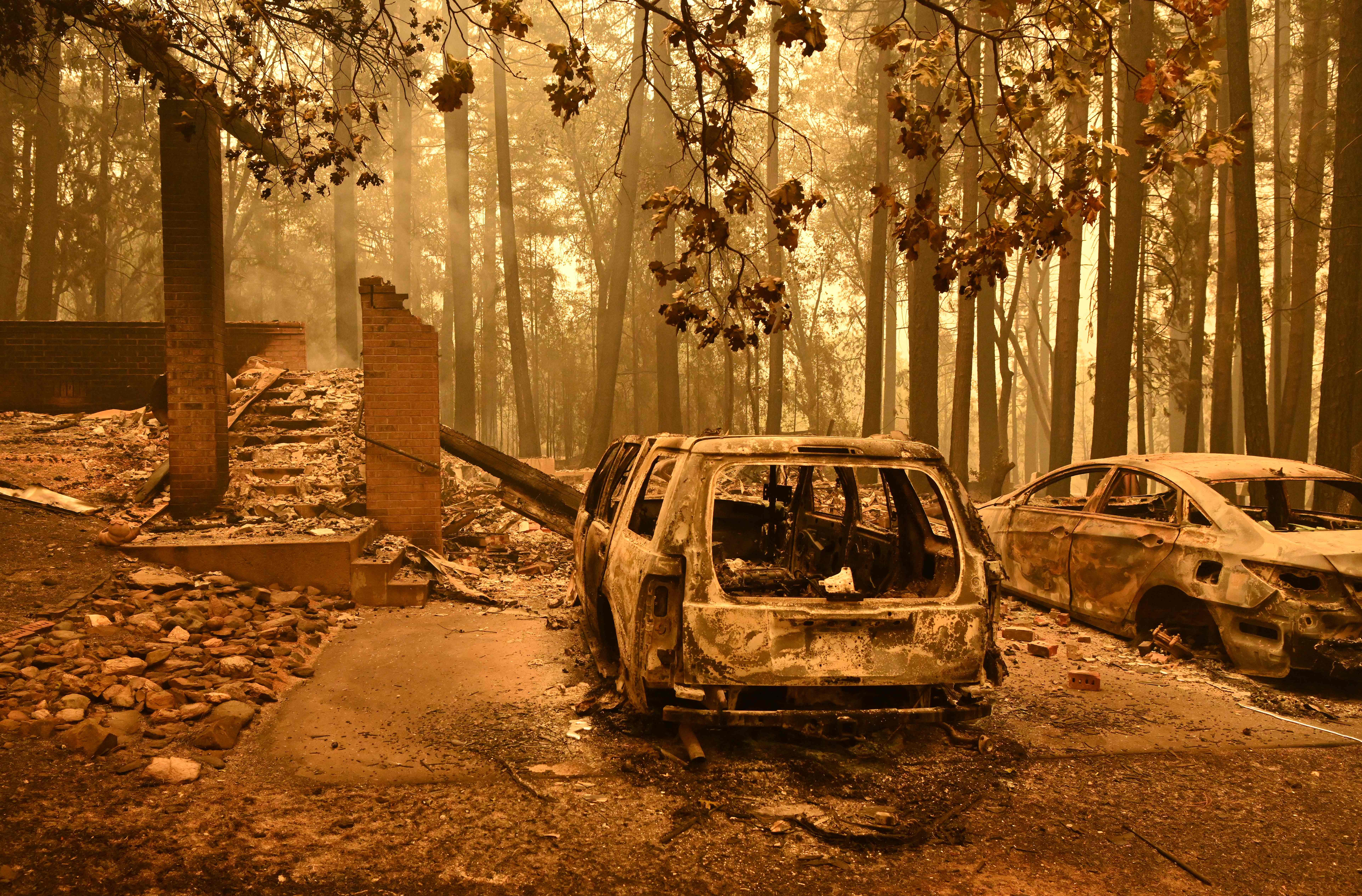
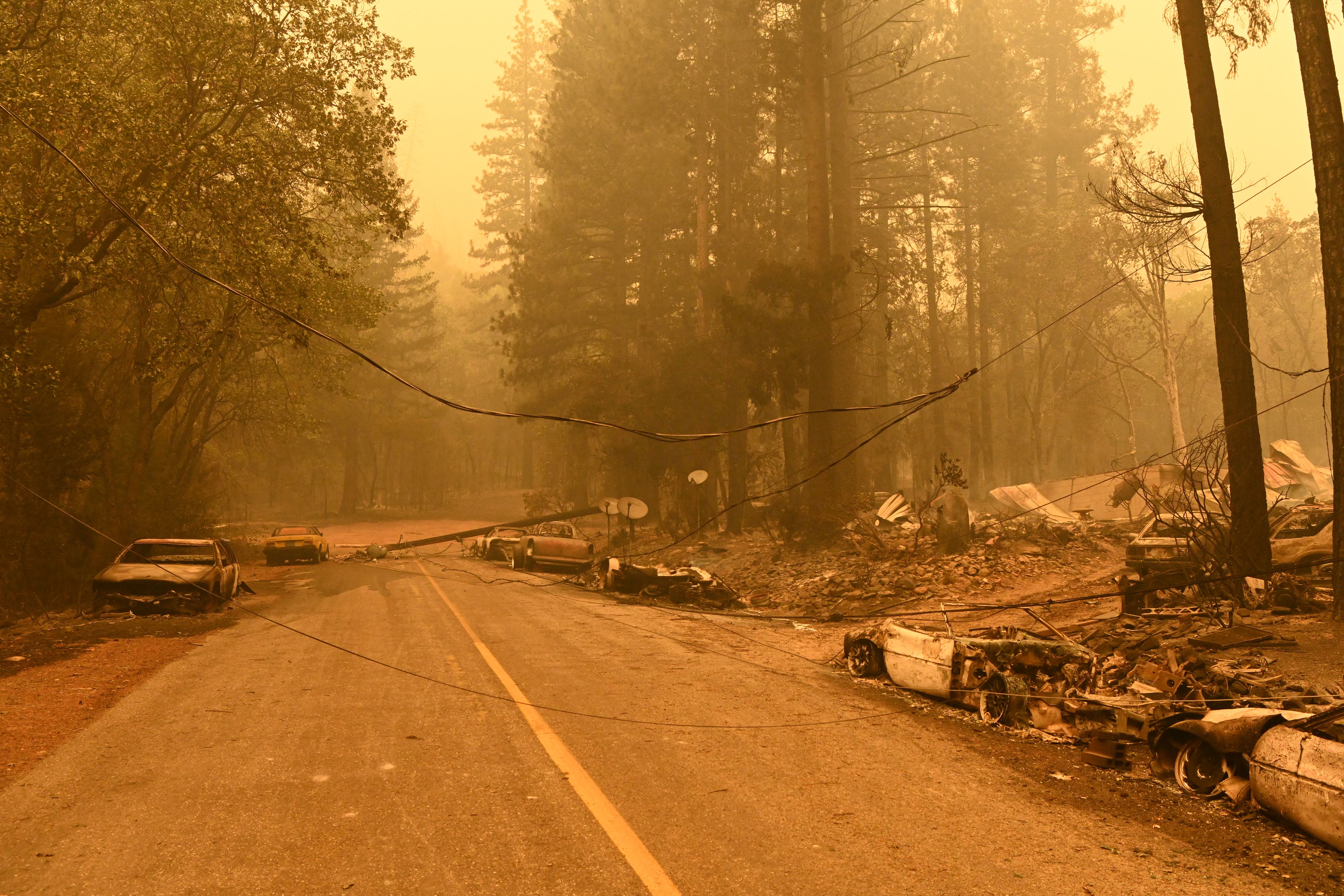
See photos of the Dixie Fire below.
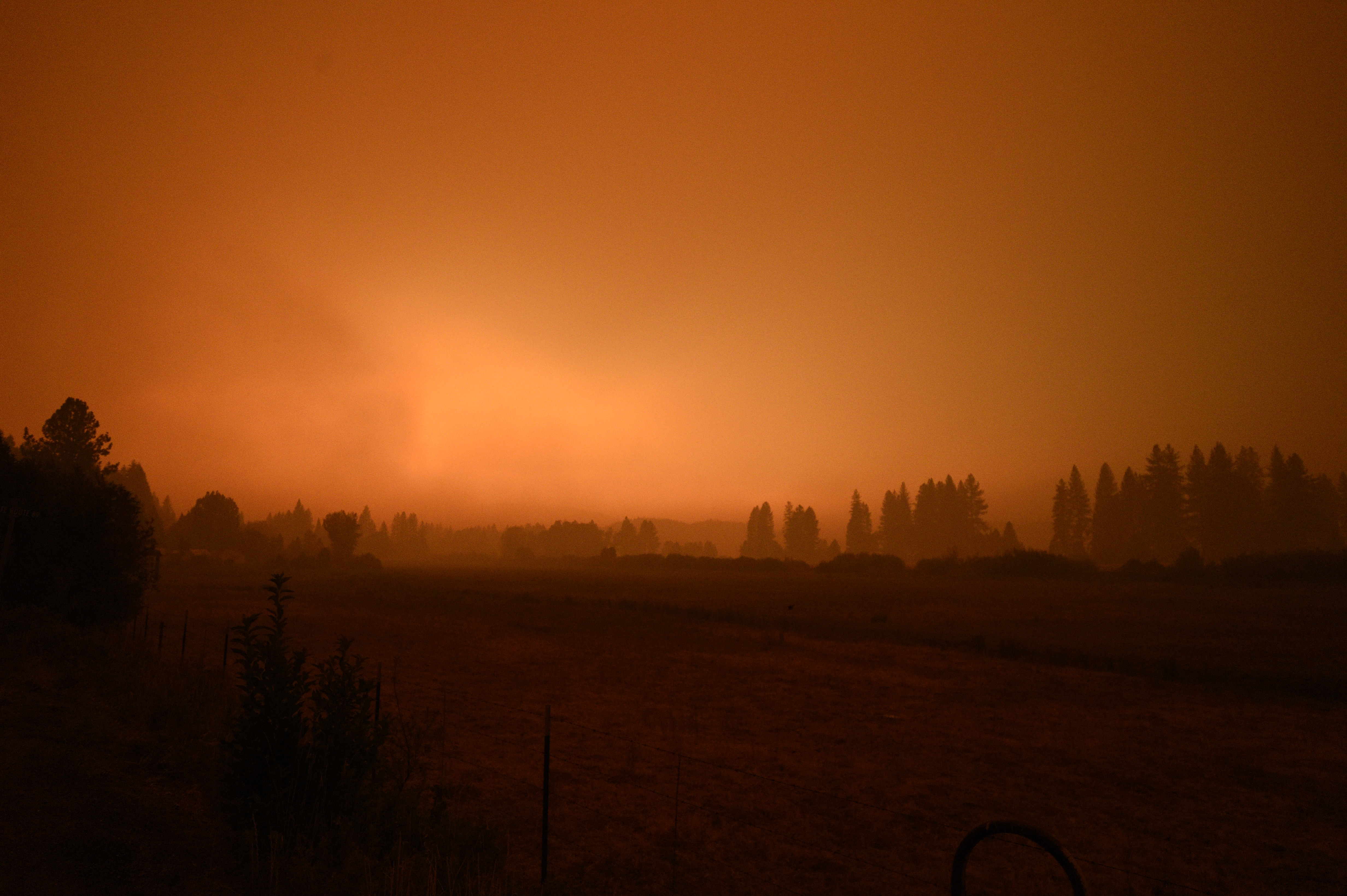
California wildfire continuesQUINCY, CALIFORNIA, USA - JULY 25: ââââââSky turns orange with smoke haze from the Dixie Fire in Greenvillein Quincy, California on July 25, 2021. (Photo by Neal Waters/Anadolu Agency via Getty Images)
California wildfire continuesQUINCY, CALIFORNIA, USA - JULY 25: ââââââFirefighters try to reach the area because of the dangerous fire on both sides of the highway as flames rise after wind caused the Dixie fire to exhibit intense fire and destroyed multiple structures in the Indian Fall area along Highway 89 in Quincy, California on July 25, 2021. (Photo by Neal Waters/Anadolu Agency via Getty Images)

California wildfire continuesQUINCY, CALIFORNIA, USA - JULY 25: ââââââFirefighters try to reach the area because of the dangerous fire on both sides of the highway as flames rise after wind caused the Dixie fire to exhibit intense fire and destroyed multiple structures in the Indian Fall area along Highway 89 in Quincy, California on July 25, 2021. (Photo by Neal Waters/Anadolu Agency via Getty Images)
California wildfire continuesQUINCY, CALIFORNIA, USA - JULY 25: ââââââFirefighters try to reach the area because of the dangerous fire on both sides of the highway as flames rise after wind caused the Dixie fire to exhibit intense fire and destroyed multiple structures in the Indian Fall area along Highway 89 in Quincy, California on July 25, 2021. (Photo by Neal Waters/Anadolu Agency via Getty Images)
California wildfire continuesQUINCY, CALIFORNIA, USA - JULY 25: ââââââFirefighters try to reach the area because of the dangerous fire on both sides of the highway as flames rise after wind caused the Dixie fire to exhibit intense fire and destroyed multiple structures in the Indian Fall area along Highway 89 in Quincy, California on July 25, 2021. (Photo by Neal Waters/Anadolu Agency via Getty Images)
California wildfire continuesQUINCY, CALIFORNIA, USA - JULY 25: ââââââFirefighters try to reach the area because of the dangerous fire on both sides of the highway as flames rise after wind caused the Dixie fire to exhibit intense fire and destroyed multiple structures in the Indian Fall area along Highway 89 in Quincy, California on July 25, 2021. (Photo by Neal Waters/Anadolu Agency via Getty Images)
California wildfire continuesQUINCY, CALIFORNIA, USA - JULY 25: ââââââFirefighters try to reach the area because of the dangerous fire on both sides of the highway as flames rise after wind caused the Dixie fire to exhibit intense fire and destroyed multiple structures in the Indian Fall area along Highway 89 in Quincy, California on July 25, 2021. (Photo by Neal Waters/Anadolu Agency via Getty Images)
California wildfire continuesQUINCY, CALIFORNIA, USA - JULY 25: ââââââFirefighters try to reach the area because of the dangerous fire on both sides of the highway as flames rise after wind caused the Dixie fire to exhibit intense fire and destroyed multiple structures in the Indian Fall area along Highway 89 in Quincy, California on July 25, 2021. (Photo by Neal Waters/Anadolu Agency via Getty Images)
California wildfire continuesQUINCY, CALIFORNIA, USA - JULY 25: ââââââFirefighters try to reach the area because of the dangerous fire on both sides of the highway as flames rise after wind caused the Dixie fire to exhibit intense fire and destroyed multiple structures in the Indian Fall area along Highway 89 in Quincy, California on July 25, 2021. (Photo by Neal Waters/Anadolu Agency via Getty Images)
California wildfire continuesQUINCY, CALIFORNIA, USA - JULY 25: ââââââFirefighters try to reach the area because of the dangerous fire on both sides of the highway as flames rise after wind caused the Dixie fire to exhibit intense fire and destroyed multiple structures in the Indian Fall area along Highway 89 in Quincy, California on July 25, 2021. (Photo by Neal Waters/Anadolu Agency via Getty Images)

California wildfire continuesQUINCY, CALIFORNIA, USA - JULY 25: ââââââFirefighters try to reach the area because of the dangerous fire on both sides of the highway as flames rise after wind caused the Dixie fire to exhibit intense fire and destroyed multiple structures in the Indian Fall area along Highway 89 in Quincy, California on July 25, 2021. (Photo by Neal Waters/Anadolu Agency via Getty Images)
California wildfire continuesQUINCY, CALIFORNIA, USA - JULY 25: ââââââFirefighters try to reach the area because of the dangerous fire on both sides of the highway as flames rise after wind caused the Dixie fire to exhibit intense fire and destroyed multiple structures in the Indian Fall area along Highway 89 in Quincy, California on July 25, 2021. (Photo by Neal Waters/Anadolu Agency via Getty Images)
California wildfire continuesQUINCY, CALIFORNIA, USA - JULY 25: A view of ashes caused by Dixie Fire near Canyondam, Quincy, California on July 25, 2021. (Photo by Neal Waters/Anadolu Agency via Getty Images)
California wildfire continuesQUINCY, CALIFORNIA, USA - JULY 25: A view of smoke caused by Dixie Fire near Canyondam, Quincy, California on July 25, 2021. (Photo by Neal Waters/Anadolu Agency via Getty Images)
California wildfire continuesQUINCY, CALIFORNIA, USA - JULY 25: Flames rise along both sides of Highway 70 and the Feather River Canyon as the main Dixie Fire and a spot fire that was also several thousand acres joined back together in Quincy, California on July 25, 2021. (Photo by Neal Waters/Anadolu Agency via Getty Images)
California wildfire continuesQUINCY, CALIFORNIA, USA - JULY 25: ââââââSky turns orange with smoke haze from the Dixie Fire in Greenvillein Quincy, California on July 25, 2021. (Photo by Neal Waters/Anadolu Agency via Getty Images)
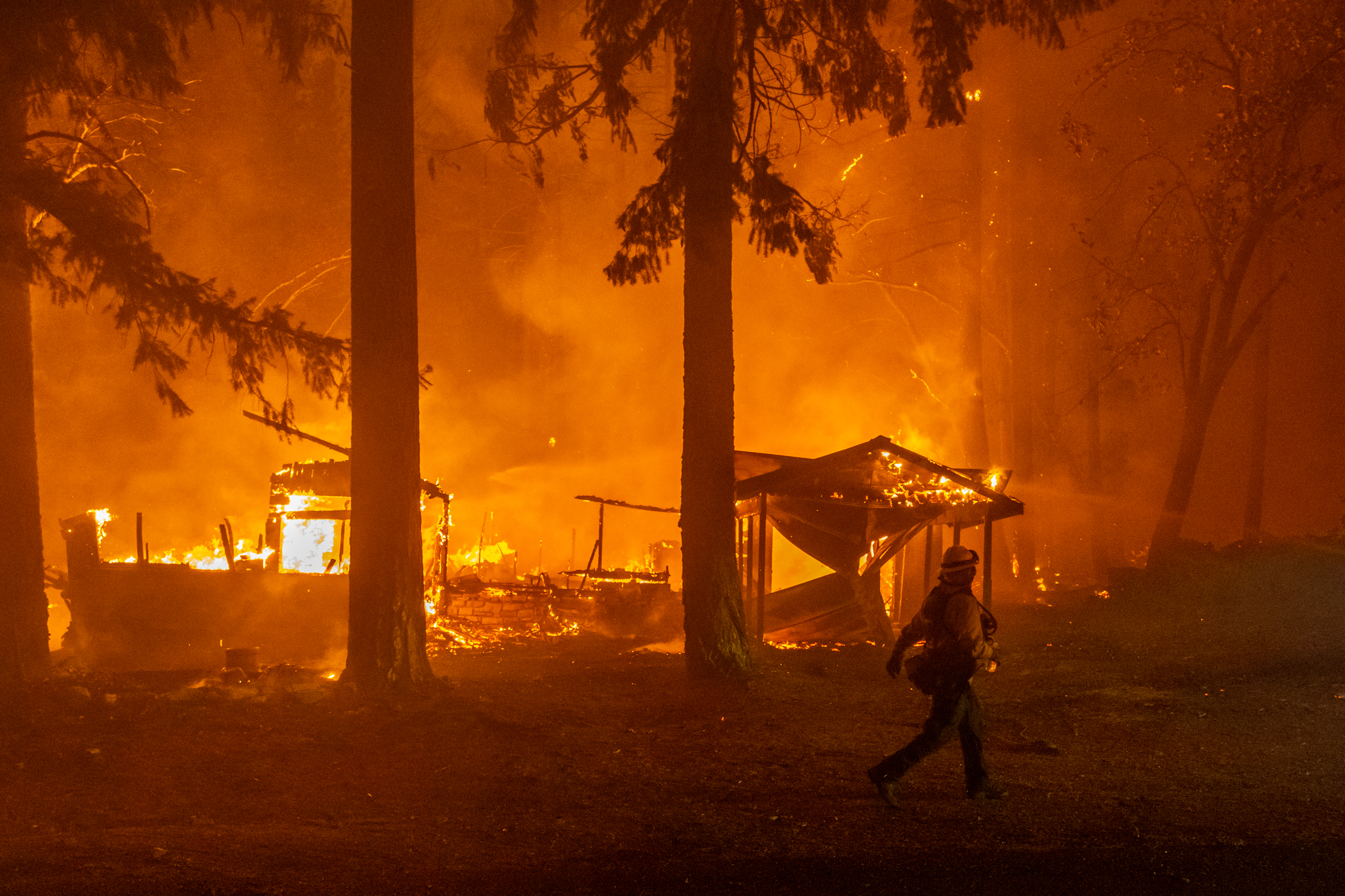
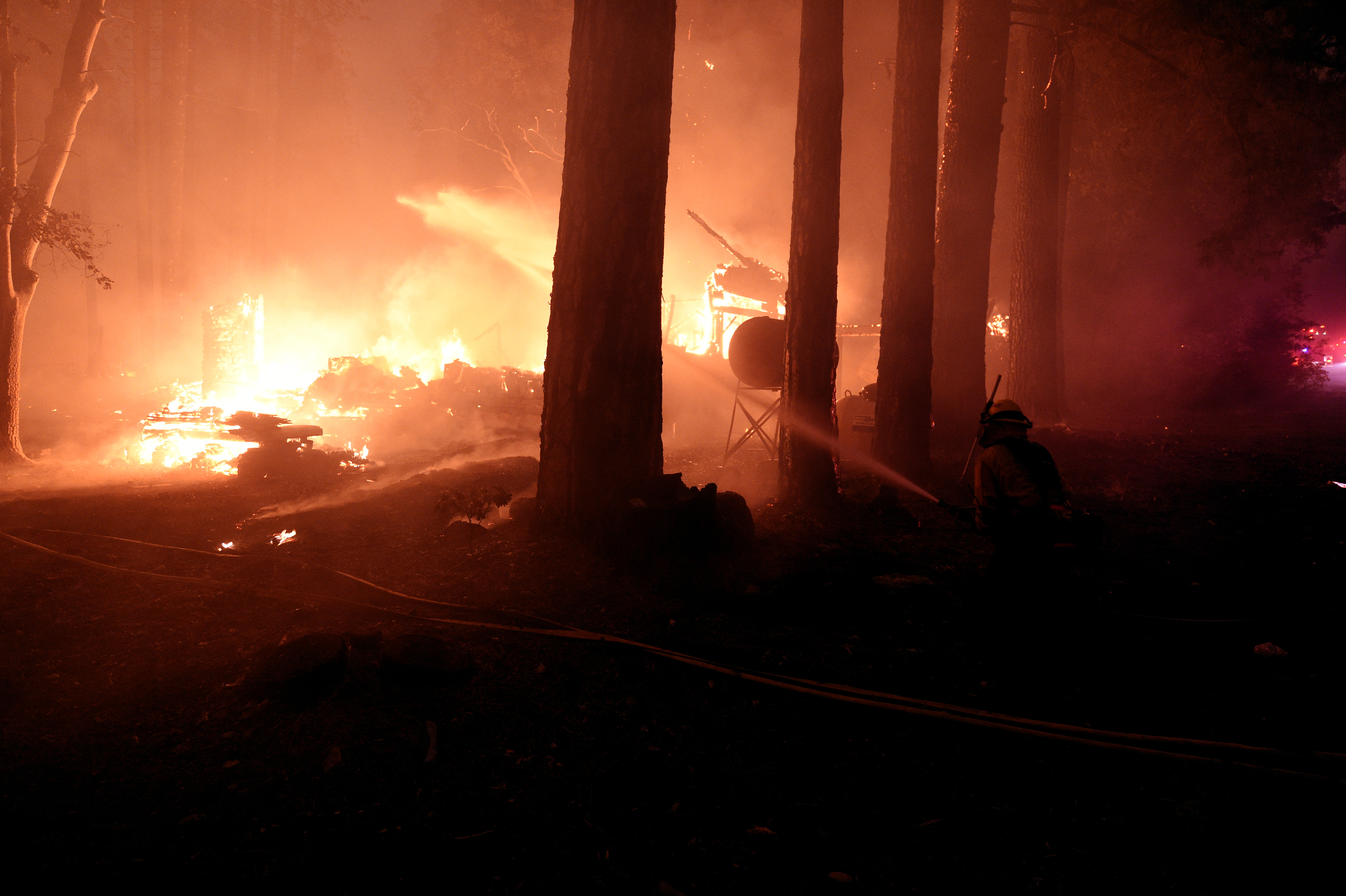
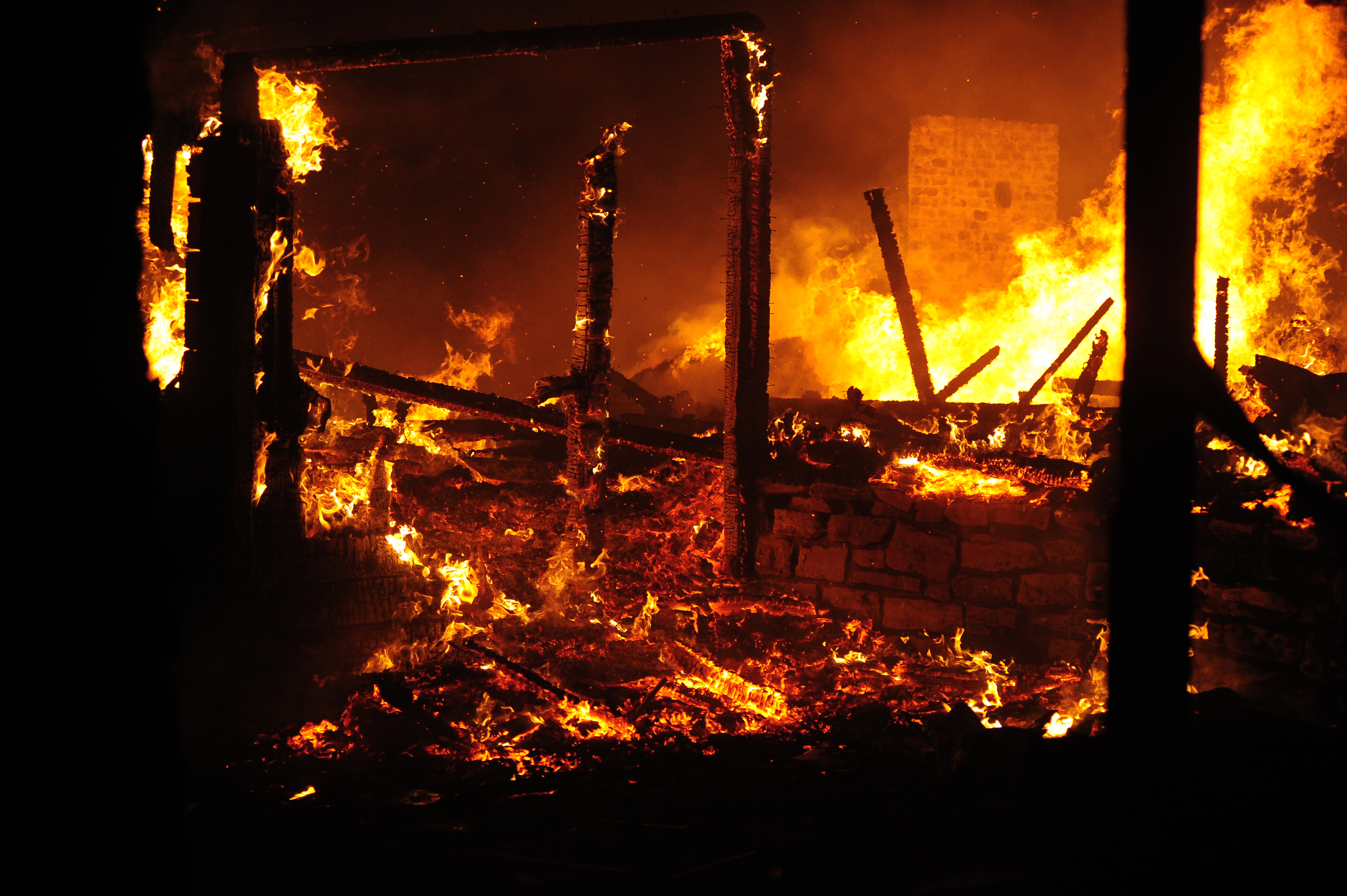
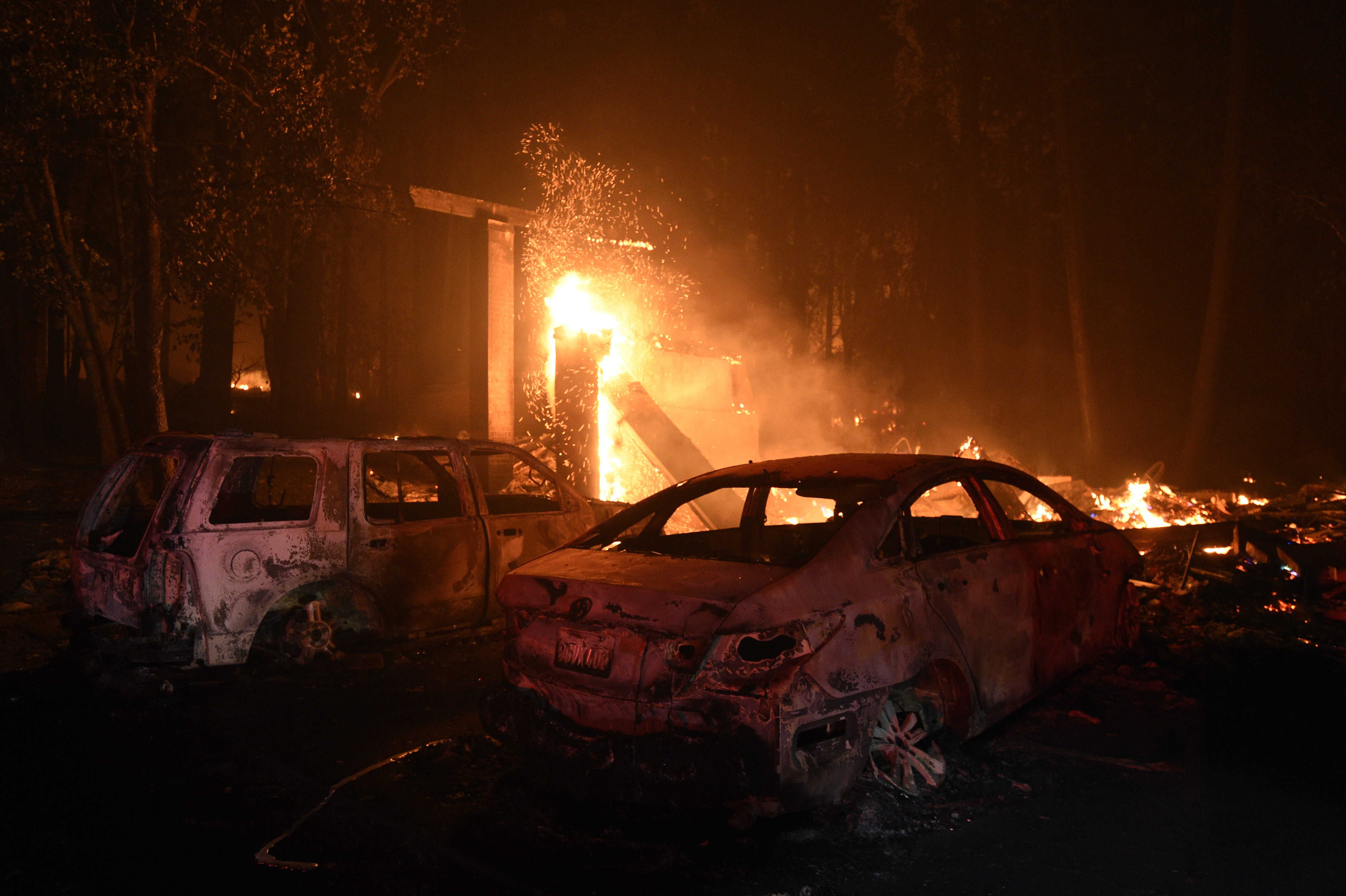
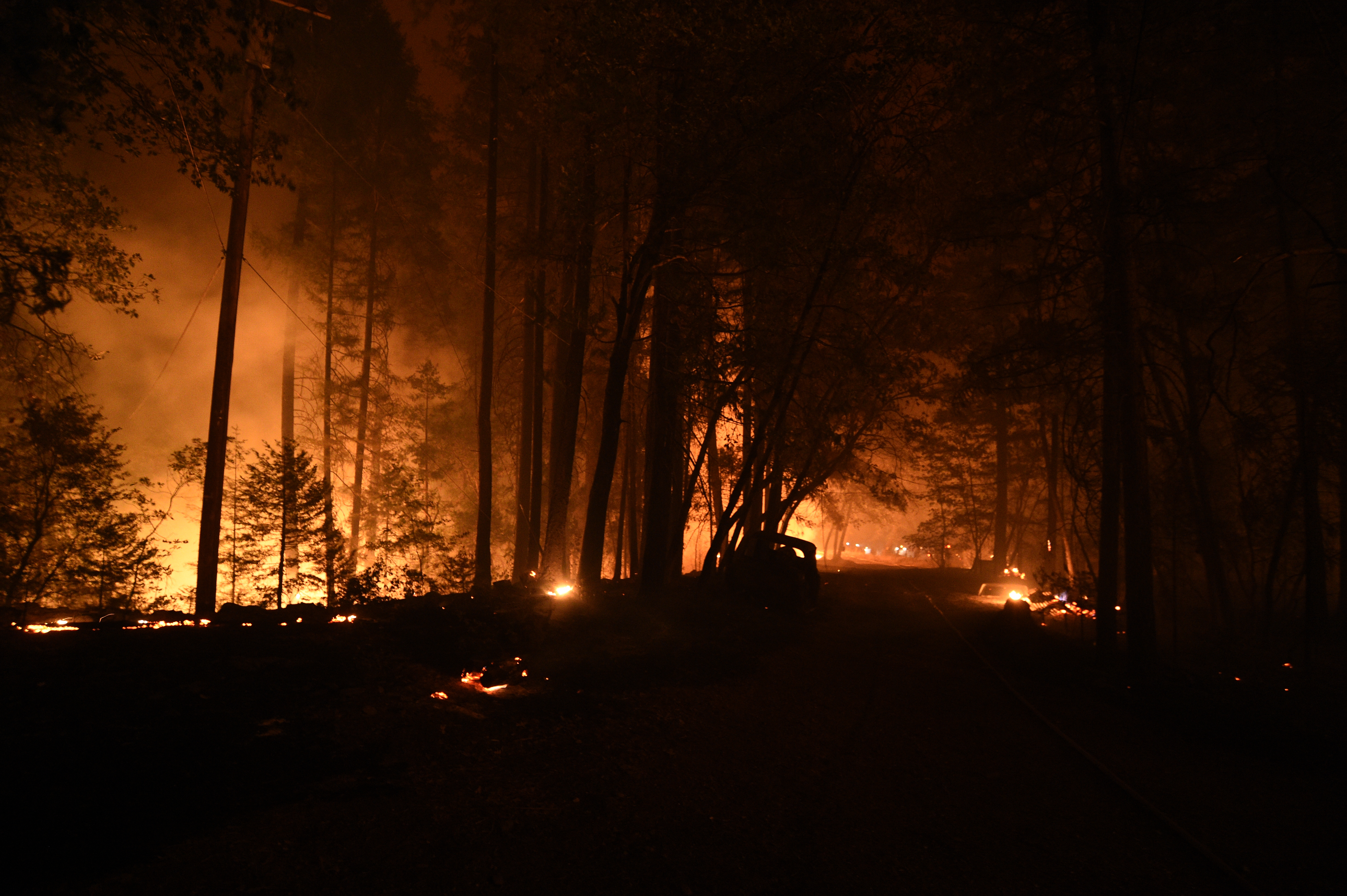
California's Dixie Fire Explodes As Western Wildfires Continue To RageA firefighter monitors a fire as multiple structures burn in the Indian Falls neighborhood during the Dixie Fire near Crescent Mills, California, U.S., on Saturday, July 24, 2021. At more than 221 square miles in size, the Dixie Fire is now the largest wildfire in California. Photographer: David Odisho/Bloomberg via Getty Images
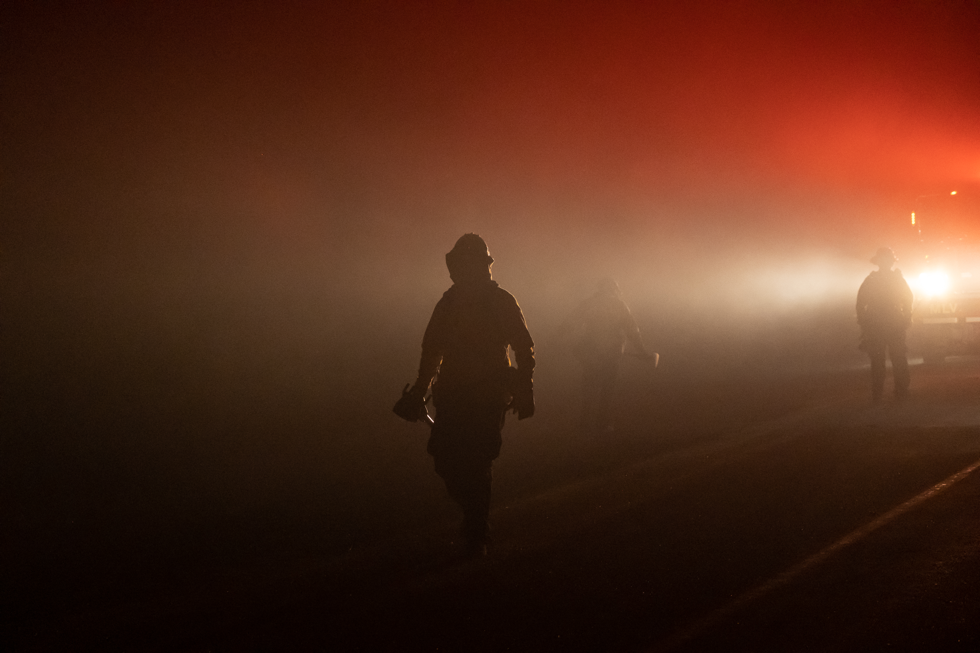
California's Dixie Fire Explodes As Western Wildfires Continue To RageFirefighters walk towards a fire in the Indian Falls neighborhood during the Dixie Fire near Crescent Mills, California, U.S., on Saturday, July 24, 2021. At more than 221 square miles in size, the Dixie Fire is now the largest wildfire in California. Photographer: David Odisho/Bloomberg via Getty Images
California's Dixie Fire Explodes As Western Wildfires Continue To RageA vehicle burns in the Indian Falls neighborhood during the Dixie Fire near Crescent Mills, California, U.S., on Saturday, July 24, 2021. At more than 221 square miles in size, the Dixie Fire is now the largest wildfire in California. Photographer: David Odisho/Bloomberg via Getty Images
California's Dixie Fire Explodes As Western Wildfires Continue To RageA firefighter monitors a fire as multiple structures burn in the Indian Falls neighborhood during the Dixie Fire near Crescent Mills, California, U.S., on Saturday, July 24, 2021. At more than 221 square miles in size, the Dixie Fire is now the largest wildfire in California. Photographer: David Odisho/Bloomberg via Getty Images
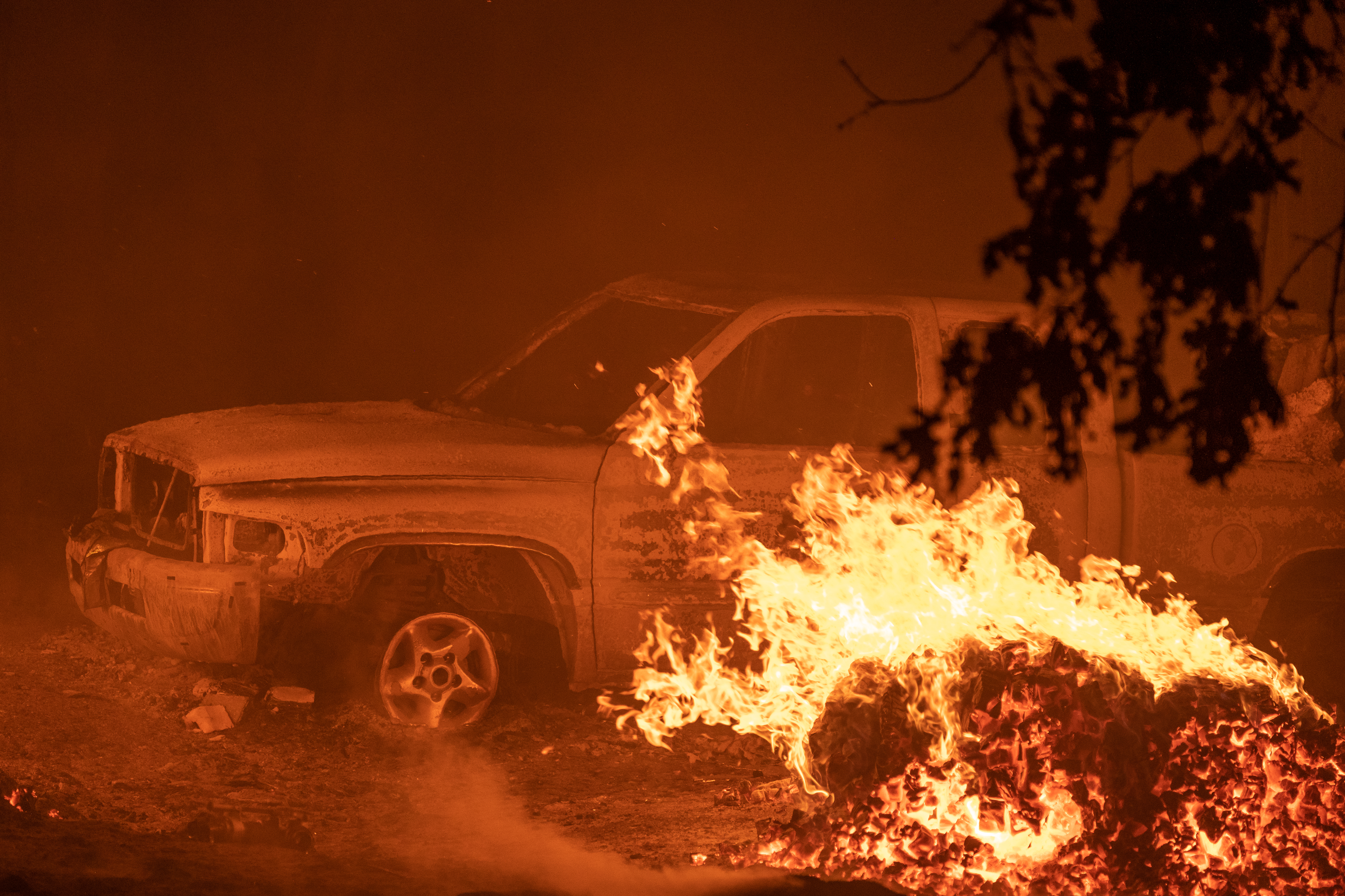
US-CLIMATE-FIREA burned motorcycle smolders during the Dixie fire in the Indian Falls area of unincorporated Plumas County on July 25, 2021. - The Dixie fire has now burned more than 190,000 acres and continues to edge closer to more residential communities. (Photo by JOSH EDELSON / AFP) (Photo by JOSH EDELSON/AFP via Getty Images)
US-CLIMATE-FIREPower lines lay on the smoldering remains of vehicles during the Dixie fire in the Indian Falls area of unincorporated Plumas County on July 25, 2021. - The Dixie fire has now burned more than 190,000 acres and continues to edge closer to more residential communities. (Photo by JOSH EDELSON / AFP) (Photo by JOSH EDELSON/AFP via Getty Images)
US-CLIMATE-FIREBurned vehicles smolder at a property during the Dixie fire in the Indian Falls area of unincorporated Plumas County on July 25, 2021. - The Dixie fire has now burned more than 190,000 acres and continues to edge closer to more residential communities. (Photo by JOSH EDELSON / AFP) (Photo by JOSH EDELSON/AFP via Getty Images)
US-CLIMATE-FIREA burnt Corvette smolders at a property during the Dixie fire in the Indian Falls area of unincorporated Plumas County on July 25, 2021. - The Dixie fire has now burned more than 190,000 acres and continues to edge closer to more residential communities. (Photo by JOSH EDELSON / AFP) (Photo by JOSH EDELSON/AFP via Getty Images)
US-CLIMATE-FIREA partially burned power pole is suspended by electrical lines during the Dixie fire in unincorporated Plumas County on July 25, 2021. - The Dixie fire has now burned more than 190,000 acres and continues to edge closer to more residential communities. (Photo by JOSH EDELSON / AFP) (Photo by JOSH EDELSON/AFP via Getty Images)
US-CLIMATE-FIREBurned vehicles smolder at a property during the Dixie fire in the Indian Falls area of unincorporated Plumas County on July 25, 2021. - The Dixie fire has now burned more than 190,000 acres and continues to edge closer to more residential communities. (Photo by JOSH EDELSON / AFP) (Photo by JOSH EDELSON/AFP via Getty Images)
US-CLIMATE-FIREDowned power lines lay across a road as burned vehicles smolder during the Dixie fire in the Indian Falls area of unincorporated Plumas County on July 25, 2021. - The Dixie fire has now burned more than 190,000 acres and continues to edge closer to more residential communities. (Photo by JOSH EDELSON / AFP) (Photo by JOSH EDELSON/AFP via Getty Images)

US-CLIMATE-FIREA fire train sprays water along railroad tracks near flames during the Dixie fire in unincorporated Plumas County on July 25, 2021. - The Dixie fire has now burned more than 190,000 acres and continues to edge closer to more residential communities. (Photo by JOSH EDELSON / AFP) (Photo by JOSH EDELSON/AFP via Getty Images)
12:50 p.m.
Overnight, the Dixie and Fly fires burning in Butte and Plumas counties burned together, making up an estimated 195,000 acres combined.
Just before noon Sunday, the Plumas County Sheriff’s Office issued mandatory evacuation orders for all of Genesee Valley and northern and eastern parts of Indian Valley, with additional warnings to follow.
Cal Fire said more than 10,700 structures were threatened by flames and at least 16 structures have been destroyed. The agency said the fire remains highly active with long-range spotting and extreme rates of spread in a remote area with limited access and steep terrain.
See a time-lapse of Fly Fire in Plumas County here.
The Dixie Fire started on July 13 at 5:15 p.m. The cause of the fire is under investigation. On Saturday, it burned across both Highways 70 and 89, according to Cal Fire.
There are currently more than 4,200 personnel assigned to the fire, including many from the Sacramento area.
Saturday’s updates below:
10:48 p.m.
Sacramento Metro Fire on Saturday said four firefighters are part of a task force assisting with the Dixie Fire.
According to Cal Fire’s website, evacuations remain in place for the following areas.
- The west shore of Lake Almanor from the Canyon Dam northwest to Highway 36 at Highway 89. This includes Prattville, Big Meadows, and Lake Almanor West along with the Rocky Point Campground and the Canyon Dam Boat Launch.
- High Lakes Recreational Area in Plumas County east of the Butte-Plumas County line, as well as the Plumas-Butte County Line east to Twain, including both sides of Highway 70 in the areas of Rock Creek, Storrie, Tobin, Belden, Caribou Rich Bar, and Twain.
- Meadow Valley and Bucks Lake, Bucks Lake Road at Riverdance, and everything west to the Butte-Plumas County line, including Snake Lake, Meadow Valley, Tollgate, Bucks Lake, Bucks Lake Highlands, and all surrounding areas.
- Caribou Road north to the Humbug Road and Humboldt Road intersection, including Belden and Butt Valley reservoirs, Prattville, Butt Reservoir Road, and everything west to the Butte/Plumas County line, and the community of Seneca south to Highway 70.
- The Paxton, Seneca, Long Valley, and East Butt Lake areas. Evacuation Warning to include the Paxton area at State Route 70 north to the Long Valley, west to the south side of Butt Lake, from the south side of Butt Lake to SR70 at Virgilia, east along the north edge of the SR70 corridor to Paxton.
- In the Long Valley and Seneca communities, starting from the Long Valley area north along Wolf Creek Road to the intersection of Wolf Creek Road and South Almanor, from the intersection of South Almanor and Wolf Creek Road west along South Almanor, continuing west along Fox Farm Road to the intersection of Humbug-Humboldt Crossing Road, from the intersection of Fox Farm Road and Humbug-Humboldt Road, to south along Prattville Butt Valley Reservoir Road.
More evacuation orders and warning information can be found here.
12:56 p.m.
Mandatory evacuation orders have been issued in the Dixie Fire which has grown to 181,289 acres and is 19% contained. Ten structures have been destroyed and 7,010 structures are threatened.
Just before 1 p.m., the Plumas County Sheriff’s Office ordered a mandatory evacuation for residents on the north side of Chandler Road, from Oakland Camp Road to Highway 70 east.
On Friday, Cal Fire issued an update detailing all of the regions under evacuation orders and those under evacuation warnings.
Friday’s updates below:
5:45 p.m.
A virtual community meeting is being held at 7 p.m. regarding the Dixie Fire. Here is the Zoom meeting link:
us02web.zoom.us/j/81721688745 USA 215-446-3649 Conference code: 746758 USA 888-557-8511 (US Free) Conference code: 746758
4:11 p.m.
Butte County has issued some information about their evacuation center and animal shelter. The evacuation center is at the Church of the Nazarene, which is at 2238 Monte Vista Avenue in Oroville.
The shelter (for small animals) is at Old County Hospital, which is at 2279 Del Oro and Mono Ste. E in Oroville at 3:45 p.m.
2:51 p.m.
An Evacuation Order has now been issued for the Butte Meadows area.
The order was previously an Evacuation Warning, according to the Butte County Sheriff’s Office.
An evacuation warning is in effect for Quincy, meaning that people need to be ready to evacuate if they are ordered to.
1:42 p.m.
With the Dixie Fire continuing to grow, smoke from the massive blaze is now drifting down into the Sacramento Valley.
Several agencies across the valley – including El Dorado Hills, Folsom and Rocklin – have posted advisories early Friday morning, alerting residents that the smoke they may be seeing is not from any active fires in their area at the moment.
People are being urged to limit their outdoor activities for the time being due to the smoke.
According to National Weather Service forecasts, it appears the smoke will eventually move out by Friday night.
8:29 a.m.
The Dixie Fire continued to grow overnight, with the wildfire now at 142,940 acres.
Containment inched up to 18 percent as well, firefighters report.
Firefighters say the flames are continuing to move north and northeast, with there still being the potential for 2-3 more miles of new growth.
Thursday’s updates below:
10:13 p.m.
Firefighters are going door to door in Greenville and Crescent Mills urging people to evacuate to the Springs of Hope church in Quincy.
The Dixie Fire is now over 103,000 acres. Cal Fire warns fire conditions will be bad the next three days.
5:55 p.m.
More evacuation orders have been issued for Plumas County.
The following Mandatory Evacuation Orders are now in effect:
Chandler Road from Highway 70 at Chandler Road west to Oakland Camp.
People are being urged to leave immediately.
Evacuees should drive eastbound to 59 Bell Lane in Quincy, the Plumas County Sheriff’s Office says.
4:33 p.m.
New evacuation orders have been issued in Plumas County.
According to the Plumas County Sheriff’s Office, the following areas are now under Mandatory Evacuation Orders:
Greenville and Crescent Mills, Round Valley Reservoir, Dixie Canyon, Indian Falls, Long Valley (west of Round Valley), Dixie Canyon south to Indian Falls, south of Indian Falls to the Hwy 70/89 Junction, Highway 70 at Black Hawk Rd north to the Highway 70/89 Junction. Also, everything on the western side of Highway 70, including Butterfly Valley, and Black Hawk.
The orders have been prompted due to a spot fire from the Dixie Fire as well as the forward progression of the incident, which remains only 17 percent contained as of Thursday afternoon.
The sheriff’s office says personnel are going door-to-door to make the evacuation notices.
10:15 a.m.
The Dixie Fire has now burned 103,910 acres as of Thursday morning, Cal Fire reports.
Firefighters say they are continuing to aggressively battle the flames, which are still moving northeast. Limited access and steep terrain remains a problem for crews.
While the incident has now been burning for a week, slightly more containment is also now being reported. After days of being stuck at 15 percent, Cal Fire reported on Thursday that containment is now up to 17 percent.
Numerous evacuation orders still remain in effect in Butte, Lassen and Plumas counties.
Wednesday night, Cal Fire confirmed that at least eight structures had been destroyed by the Dixie Fire so far. It’s unclear if any of those structures were homes, however.
Wednesday’s updates below:
9:25 p.m.
According to Cal Fire, at least eight structures have been destroyed by the Dixie Fire. The agency said it could not confirm yet if any of the structures were homes.
As of Wednesday night, the fire has grown to 91,268 acres and was still 15% contained.
8:46 a.m.
The Dixie Fire burning in Butte County has now grown to 85,479 acres as of Wednesday morning, Cal Fire reports.
Containment still stands at 15 percent, the number it has been stuck at since the weekend.
Firefighters reported that the wildfire remained active overnight. Cal Fire says the wildfire is continuing to move northeast, with 2-3 miles of area possibly being burned.
Existing control lines from the previous Bear and Chips fires are helping firefighters, as the Dixie Fire is now well established in that previous burn scar.
Several evacuation orders and warnings remain in effect in both Butte and Lassen counties.
Tuesday’s updates below:
7:40 p.m.
As of Tuesday evening, the Dixi has burned 61,376 acres and containment was still at 15%, according to Cal Fire.
The agency said 810 structures remain threatened by the fire, and so far, two structures have been destroyed.
7:43 a.m.
The Dixie Fire continued to grow overnight, with Cal Fire reporting that size had jumped to 59,984 acres as of Tuesday morning.
Containment still stands at 15 percent, the same as it was on Monday.
Firefighters say the flames are continuing to move to the east and north. With isolated thunderstorms possible Tuesday afternoon into the evening, firefighters are also concerned for new starts.
Evacuation orders remain unchanged since Monday.
Hard closures of Highway 70 at Deadwood and Bucks Lake Road at Plains Road also remain in effect.
Monday’s updates below:
9:15 p.m.
Cal Fire said Monday night that the Dixie Fire in Butte County has grown to burn 40,500 acres and was still 15% contained. The agency said crews will continue to work through the night on widening and strengthening control lines that are in place.
Though it was an active day overall for the fire, Cal Fire warns that the area may experience isolated thunderstorms. Lightning strikes have already been the cause of several wildfires throughout Northern California.
6:55 p.m.
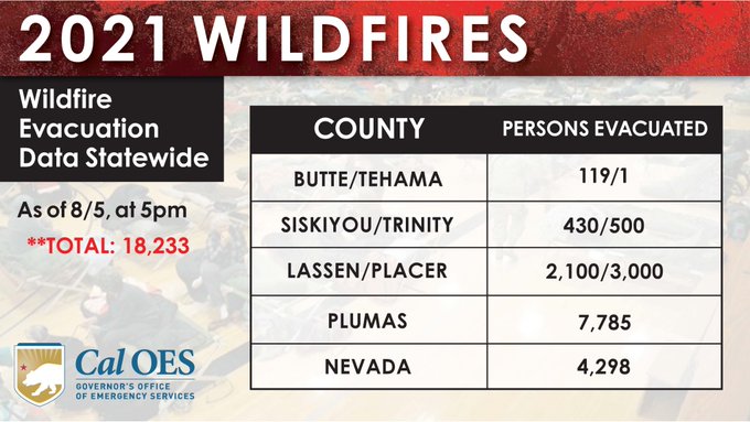
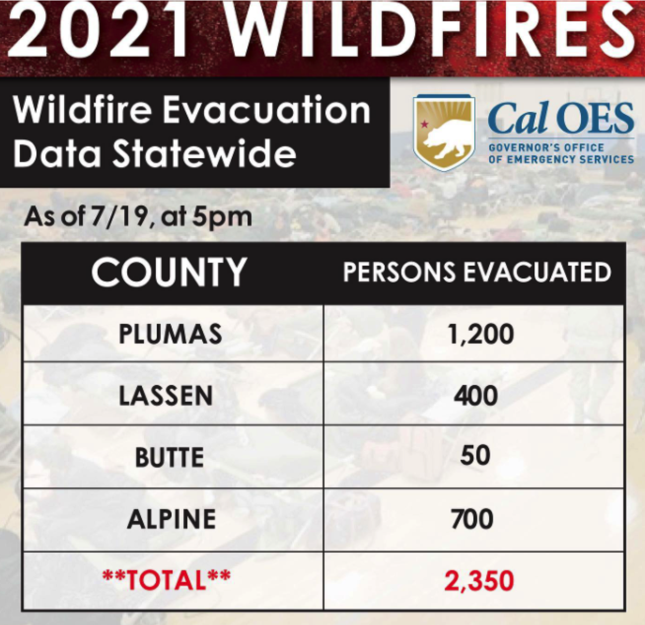 The California Office of Emergency Services released data Monday evening on how many people were evacuated due to wildfires in the state. Due to the Dixie Fire, approximately 1,250 people were evacuated from their homes in Butte and Plumas counties.
Evacuation orders from the weekend were still in place for the High Lakes Recreational Area in Plumas County east of the Butte-Plumas County line, as well as the Plumas-Butte County Line east to Twain, including both sides of Highway 70 in the areas of Rock Creek, Storrie, Tobin, Belden, Caribou Rich Bar, and Twain. Mandatory evacuations are also in place for the areas of Meadow Valley and Bucks Lake, including Bucks Lake Road at Snake Lake Road and west to the Plumas-Butte County line, including the area of Tollgate.
On Monday new, evacuation orders were issued for the area from Twain east to Paxton and the Greenville Wye (Highway 89 at Highway 70) and the community of Seneca and the area south of it to Highway 70.
Evacuation warnings are also in place for the Butte Meadows and Inskip areas.
6:00 p.m.
Evacuation orders now include the area from Twain east to Paxton and the Greenville Wye (Highway 89 at Highway 70), authorities said.
3:52 p.m.
The Plumas County Sheriff’s Office said mandatory evacuations for the Dixie Fire have been expanded to include the community of Seneca and the area south of it to Highway 70. Residents should leave immediately.
As of Monday, the Dixie Fire has burned 30,074 acres and was still at 15% containment.
Evacuation orders remain in place for the High Lakes Recreational Area in Plumas County east of the Butte-Plumas County line, as well as the Plumas-Butte County Line east to Twain, including both sides of Highway 70 in the areas of Rock Creek, Storrie, Tobin, Belden, Caribou Rich Bar, and Twain. Mandatory evacuations are also in place for the areas of Meadow Valley and Bucks Lake, including Bucks Lake Road at Snake Lake Road and west to the Plumas-Butte County line, including the area of Tollgate.
Evacuation warnings are also in place for the Butte Meadows and Inskip areas.
Additionally, Pacific Gas & Electric Company says its equipment was possibly involved in the start of the now 30,000-plus acre Dixie Fire.
Sunday’s updates
8:50 p.m.
Cal Fire said Sunday night that the Dixie Fire has grown to burn 18,702 acres, while containment was still at 15%. There was “significant fire activity” Sunday and the flames continued moving southeast toward Bucks Lake, the agency said.
According to Cal Fire, 810 structures are threatened by the fire. No structures have been destroyed and there have been no other injuries reported.
6:33 p.m.
More evacuations have been ordered as a result of the Dixie Fire burning in Butte County.
The Butte County Sheriff’s Office has ordered mandatory evacuations for the areas of Jonesville and Philbrook.
According to Cal Fire, the Dixie Fire has scorched more than 15,000 acres and was 15% contained.
Evacuation orders are also still in place for multiple areas in nearby Plumas County, including High Lakes from Rock Creek to Tobin. Additionally, evacuation warnings are in place for the Butte Meadows and Inskip areas, and the area east of the Rock Creek Dam to Caribou, including both sides of Highway 70 in the area. Highway 70 in the area is closed.
One firefighter suffered minor injuries during Thursday’s firefight, according to Cal Fire. This was the only injury reported so far in the Dixie Fire. Cal Fire said the firefighter was able to walk away.
(© Copyright 2021 CBS Broadcasting Inc. All Rights Reserved. The Associated Press contributed to this report.)
"still" - Google News
August 08, 2021 at 10:25PM
https://ift.tt/2VAtY4w
Dixie Fire Now 2nd Largest-Ever CA Wildfire, 2 People Still Missing - CBS Sacramento
"still" - Google News
https://ift.tt/35pEmfO
https://ift.tt/2YsogAP
Bagikan Berita Ini


0 Response to "Dixie Fire Now 2nd Largest-Ever CA Wildfire, 2 People Still Missing - CBS Sacramento"
Post a Comment