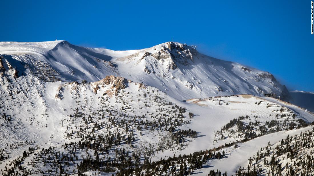
(CNN)Thanks to multiple atmospheric river events, average snowpack in California has gone from 18% to 98% in just two weeks.
"Increases in snowpack of this size are not common, but also not unprecedented," Julie Kalansky, deputy director of operations for the Center for Western Weather and Water Extremes (CW3E), explained.
Kalansky pointed out previous studies have shown a jump on this scale can happen about twice every three years, but usually over the course of an entire winter, not just the month of December.
While they don't have the exact rankings for each month of the year, "most of the storm events in the study we referenced for the above calculation were in the second half of December and later into the season," Kalansky added.
The sudden change gives California its wettest start to the Water Year in more than 40 years, thanks to several drought-denting rain and snow systems pushing through the area in recent weeks. The Water Year runs from October 1 through September 30 of the following year.
Parts of California are known for whiplash weather, but the rapid changes are quite remarkable given the snowpack was off to such a rough start, after a very warm and dry November for much of the state.
Northern California is doing a little better in terms of its water year, compared to where it was last year. While not at record levels, the National Weather Service (NWS) office in Sacramento tweeted the Northern Sierra precipitation is above average for this time of year, and exceptionally better than the same time last year.
However, Southern California was only able to take advantage of one of the larger atmospheric river systems recently.
"The Tuesday storm that brought 1 to 2 inches of rain to the coastal and valley areas put a dent in our rainfall deficit," the NWS office in San Diego said last week.
The area was so far behind prior to last week's storm, the recent rainfall only brought the region back to where it normally should be at this time of year, rather than ahead.
California is just one state in the West, and not all states are equal in terms of moisture received by recent storms.
"While stormy weather in December increased snowpack in California, snow water equivalent is at record lows in some stations in NM, CO, UT, MT, WY, NV," the National Integrated Drought Information System (NIDIS) said in a tweet.
The Sierras can collect a lot of the moisture from big storms, but block it from entering neighboring states.
A US Department of Agriculture snow mapping tool showed while some areas of California, Oregon, Washington, Nevada, and Arizona have relatively high snow water equivalent percentages, other states such as Colorado, New Mexico, and Wyoming are struggling, compared to average totals.
Snow deficits in Colorado affect millions more people beyond the state's borders. When the snowpack melts in the spring it supplies the Colorado River Basin's water supply.
Chelsea Peters, a meteorologist with the NWS office in Las Vegas explained Intermountain West snowpack, or lack thereof, can have cascading impacts on southwestern states, especially if snowpack levels are below average for several years in a row.
"Several years of below-normal snowpack across the Intermountain West mountains that supply the Colorado River Basin will continue to increase the water supply stress, which was already in jeopardy due to population increase," Peters said. "We recently saw this impact reservoir storage and lake levels in Lake Mead and Lake Powell. Within the last year, both Lake Powell and Lake Mead have observed their lowest reservoir storage levels in 30 years."
More storms on the way
More rain and snow is entering the West Coast thanks to three separate waves of moisture.
The first arrived Saturday in the Pacific Northwest, bringing heavy coastal rain and mountain snow, creating dangerous travel conditions along the Cascades.
Sunday, the low pressure system will shift south into Oregon and northern California.
Snowfall totals will range from 3-6 inches for interior northwestern states, with as much as 2-3 feet for the highest elevations of the Cascade, Sierra, and northern Rocky Mountains.
The CW3E is forecasting a Level 3 atmospheric river event for the western states.
An atmospheric river pumps incredible amounts of moisture off the Pacific Ocean into Western states, resulting in very heavy rain and snow.
By Monday and Tuesday, heavy precipitation will spread from Washington to central California.
"Rain and snow chances return by early next week, becoming widespread by late Monday," the NWS office in Sacramento said Saturday. "A series of storms will continue this threat through the week into next weekend. Mountain travel will likely be significantly impacted at times."
Over the next five days, widespread rainfall totals of 2-4 inches are expected along the coastlines and lowlands.
"still" - Google News
December 19, 2021 at 05:01PM
https://ift.tt/3E5hyBL
California snow drought ends in dramatic fashion, while other states still deal with shortage - CNN
"still" - Google News
https://ift.tt/35pEmfO
https://ift.tt/2YsogAP
Bagikan Berita Ini


0 Response to "California snow drought ends in dramatic fashion, while other states still deal with shortage - CNN"
Post a Comment